
Ahead of me was another visitor to the lake, clutching “Le Guide du Routard” and speaking in an unmistakable French accent. We shared a table and spoke for a couple hours, before heading out for a walk around the Taylor Creek marshes under a heady rain. What would come to pass as an unusual stop for coffee for Eric, and a daily routine for me, cultivated a long-distance friendship over the last year. When I decided to go back to northern Arizona in late August, Eric agreed to join me.
Eric works for a well-known American corporation as a software consultant, a nebulous title that affords him unequalled benefits, to say nothing of his pay: his employer extends him both French labor advantages and American perks, such as they are. In summary, he bags seven weeks of paid vacation in addition to French and American holidays. But Eric collects these tantalizing benefits in a far from tantalizing city: He calls Moline, Illinois, home, a city across the Mississippi River from his former Bettendorf, Iowa, digs. He is not overly fond of either, or of the other two that make up the Quad Cities.
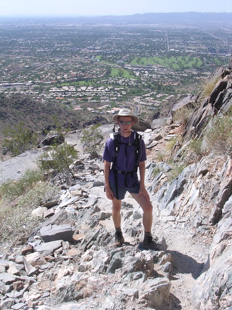
Free time and willingness to explore are not necessarily congruent. As my trip would involve some serious hiking, I forwarded suitable disclosures to avoid unpleasant realizations. The length and difficulty of the trails did not deter Eric who had said during our first (and only) meeting that he had hiked to the top of Yosemite’s Half Dome. This impressive feat convinced me he knew what he was getting into if he had managed to climb almost 5,000 feet/1.500 meters in about 8 miles/13 km.
We timed our flights to arrive in Phoenix at the same time. After briefs stops at Trader Joes and REI, we left the urban sprawl for the open Sonora desert and made our way to the very funky Arcosanti. Best described as an architectural and ecological experiment forever in progress, Arcosanti aims to become a fully self-sustained development. Up to 5,000 people are to live and work in a mildly futuristic structure surrounded by irrigated fields. The effect could be post-modern and bleak, but it is instead oddly endearing. I helped myself to a couple bagels, cream cheese and jam from an honor-system kitchen and Eric prepared his potion, a mixture of re-hydrated fruits and vegetables. (His diet conforms very poorly to industrialized feeding.)
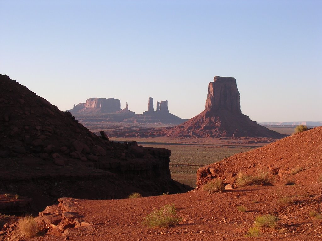
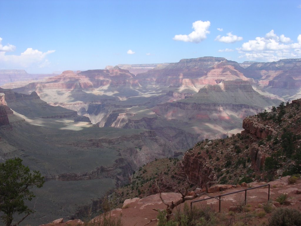
We lingered a tad too much and showed up 10 minutes too late at the V bar V Ranch and missed out on an impressive collection of elaborate Sinagua petroglyphs on rock panels by Beaver Creek. Minutes before, somehow, I had missed the turnoff to Montezuma Castle National Monument, site of neither a visit by Montezuma nor a castle, but of Sinagua cliff dwellings. We left empty-handed, but our heads soon filled with the magnificent red rock formations towering over Oak Creek and Sedona.
The city abuts the Mogollon Rim escarpment where forested woodlands erode into shrubby desert. The transition could hardly be more dramatic. This very special place has always attracted people who think of themselves as very special. Since the harmonic convergence of the late 1980s, the magnificent mustard and red buttes have been deemed to be the repository of energy vortexes, where the earth’s force is magnified. The rocky cathedrals have hosted New Age pilgrim, aura and crystals in tow, on a quest for enlightenment.

At a minimum, the pursuit will cost you $5 to investigate the metaphysical and psychic properties of public lands. The Coconino National Forest asks you to pony up for a “Red Rock Pass,” a bargain considering the commercial alternatives.
We breezed through Flagstaff, and pointed the car north on US 89, this most gloriously scenic highway for its entire journey across Arizona, Utah, Wyoming and Montana. As we left Gray Mountain behind, nothing in the painted desert scenery spoke to the change that had just occurred. We were still in Arizona, still in Coconino County, and no highway sign heralds the switch, but we have entered a new universe.
This is Indian land. A separate-but-equal legal entity with laws and regulations that may or may not contravene those of the county or state. This largest of all Indian trust lands in the United States stretches over 27,000 square miles/70,000 km² (slightly smaller than Maine or Austria) and is home to 174,000 Navajos. It operates under an elected president and council with executive, legislative and judicial powers that regulate personal and business matters for all within the reservation boundaries. But as a trust land – an appellation few Native Americans relish – the federal government is ultimately in charge, typically by the bias of the Bureau of Indian Affairs, and it acts as a mediator with states.
The Navajo Nation is divided into agencies and chapters, which act as hubs on the sparesely populated rez. Driving around, it is hard to detect much significant business activity. Mining, logging, ranching and grazing anchor the economy. Tourism plays a significant role, whether as paying guests in hotels or through the sales of artwork. At trading posts, commodities change hands, although they perform now more like regular convenience stores.
Ultimately, many development opportunities fail to come into being simply because the mind set snubs the resource exploitation model that shapes and directs Western attitudes. For traditional and practical reasons, there is no private land ownership on most reservations, thereby eliminating an essential speculative tool of capitalistic economies. Because reservations must function within the greater American society, it is surprising that external pressures – to say nothing of historical conflicts – have not plowed Native Americans under.
Non-Indian visitors need to surrender many of their cherished social expectations when exploring reservations. The languid notion of time may exasperate a few accustomed to speed. Things happen when they happen. Obsessed by what we call efficiency, we might be put off by elastic store hours, relaxed restaurant service, delayed events, reluctant interlocutors, restricted access.
I find this altered sense of place and time quite alluring. It is not just figurative, either. Unlike Arizona, the Navajo Nation observes daylight savings time and its communities are one hour ahead of the rest of the state. But the Hopis, whose reservation lies wholly within the Navajo’s, do not observe summer time, creating a complicated time zone conundrum made worse by the partitioned lands. The Hopi village of Moenkopi sits across the road from Navajo Tuba City, a few feet and an hour distant. I remember calculating that a trip from Tuba City to Ganado requires adjusting one’s watch six times for a journey of 125 miles/200 km! Why bother with such relative concept?
We had to stop in Tuba City, if only because we were hungry. As it happens, I have spent an unholy amount of time in this unremarkable community, and from this fact has grown a sentimental attachment that I needed to redeem with a Navajo Taco. Eric was vastly more particular, in true fashion, and puzzled our waitress with his requests. He is not a vegetarian, but often ends up eating just that as he finds – correctly – little on menus that is not either over sweetened or processed. He ends up reconstructing the offerings into a plate that satisfies his palate by picking ingredients from several dishes on the menu. At this restaurant, he was invited into the kitchen for a little conference with five employees on the finer points of healthy eating. It is ironic, of course, that Indians have grown corn for centuries in very sustainable fashion, and now eat - like the rest of us - a contemporary corn that has undergone genetic modification, recalibration and re-engineering at the molecular level. This corn, estranged from its ancestral origins, shows up in most of our foodstuff, seldom as a kernel, with devastating results.
For dessert, I joked that Eric wanted a green bean ice cream. After a pause, our waitress guffawed. She proceeded to share with us her plans for the evening with her boyfriend at the church behind the airport.
“The Tuba City airport???” I inquired.
For many years I have wanted to visit Navajo National Monument to go horseback to the Keet Seel ruins. No good things come to those who wait: The horse trips have been canceled and the journey is now strictly on foot, limited to 20 people daily.
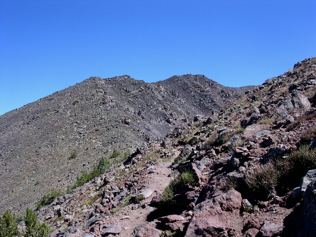
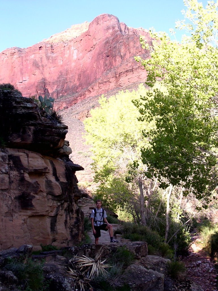
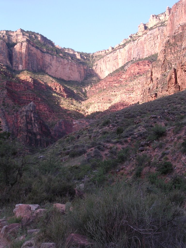
After an incomplete breakfast of (free) fry bread at the Holiday Inn in Kayenta in a restaurant filled with Italian tourists - ma perchè ci sono tanti italiani in questo posto?? Cosa è successo che non so? Prego, mi prendano con loro - we reached the visitor’s center shortly after 8 am for our orientation. The Park Service wants to make sure hikers know what they’re in for along the 17-mile/27-km journey. We listened to the usual admonitions and followed, as best we could, the narrative that accompanied the photos in a three-ring binder. Each presented us with a visual preview of segments of the trail, with the goal to memorize certain trees, bushes, formations, mile markers, white posts, after which we needed to take decisive action. Large red arrows pointed to the direction we would need to follow, but after page 10 I lost track of how many rights and lefts we had to recall.

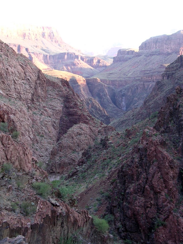
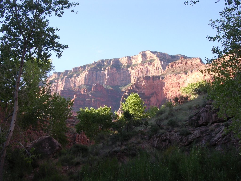
Armed with sketchy maps, we located the parking lot and the subsequent two brown and red gates. The air was coolish atop the mesa at 7,000 feet/2.100 meters. At Tsegi Point, the landscape opened up to reveal the steep-sided canyons below. In the next mile, the trail dropped 800 feet/250 meters. At the confluence with Laguna and Dowozhiebiko creeks, we chatted with a trio from California, also on their way to Keet Seel. We proceeded upstream in Dowozhiebiko Canyon on a primitive trail, scanning the horizon for memorable trees, bushes and formations, relieved when we were able to locate the next mile marker or white post.
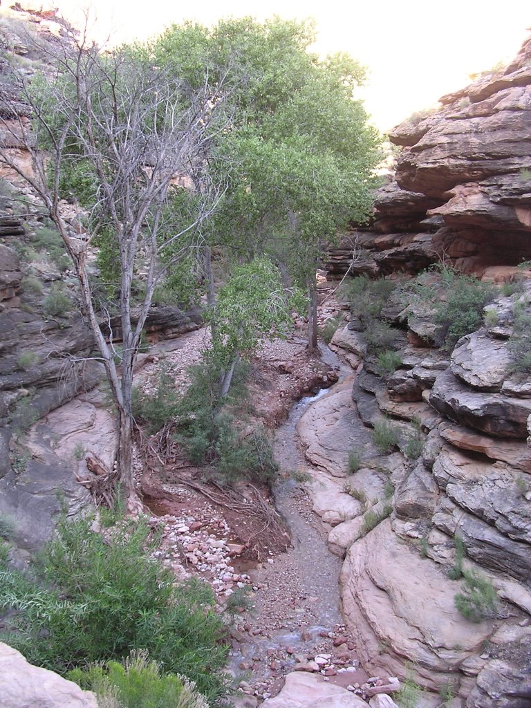
We bore left into the Keet Seel tributary. The many creek crossings, sandy spots and, better still, quicksand impeded and slowed our progress. We trudged along with muddy boots. Occasional cattle and horses eyed us with perplexed glances. While Navajo National Monument is a federal park, it encompasses tribal lands and animals wander about. Under park stewardship, visitors have the only such foremost opportunity on the rez to hike unaccompanied. It is a treat!
We passed the first “waterfall,” site of a pool of water but no cascading runoff. At the second one, we lost the main trail momentarily and ended up in a box canyon. To avoid deep quicksand in the canyon bottom, the trail rose to a low mesa and traveled up and down gullies. Finally, we spotted the cliffside dwellings and approached the ranger’s hogan.

“FedEx delivery,” I announced as I knocked on the door.
His face smeared with possibly a tad too much sunscreen lotion, Ranger Robert Benaly suggested we join another couple and had a snack before going on the tour. These Nebraska folks had left an hour and half before us and had arrived moments before.
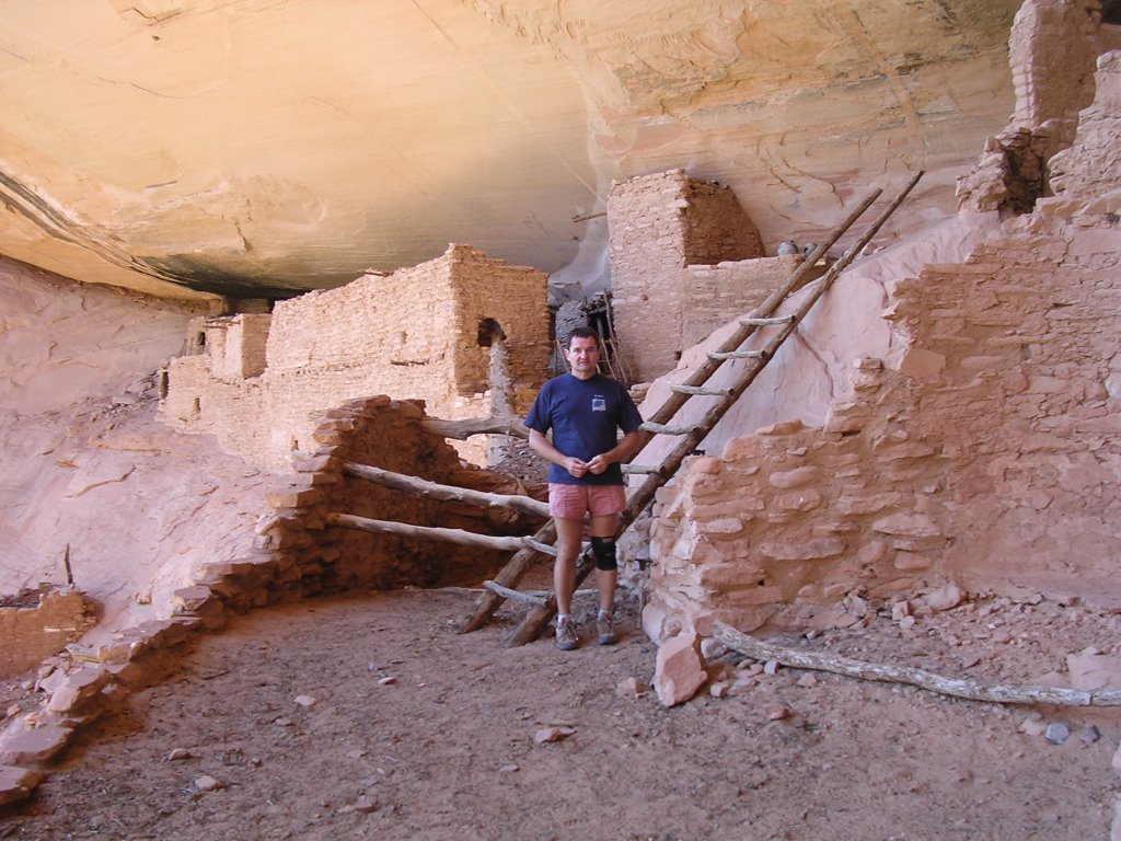
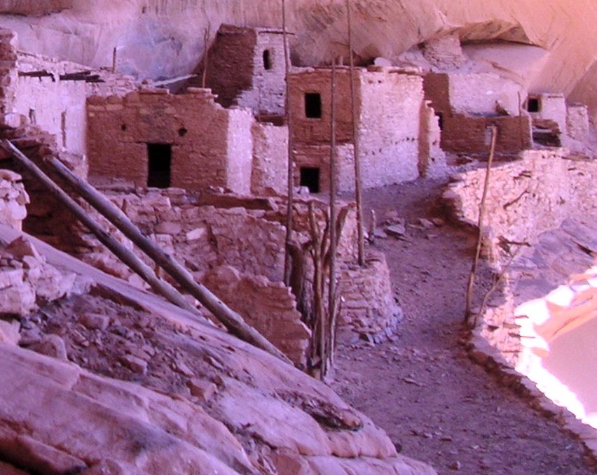
Satiated (well, not quite...), we climbed up a 70-foot/21-meter ladder bolted into the sandstone cliff to the Keet Seel ruins, built and inhabited by generations of Anasazi people until the 1200s when – like many other such villages in the Southwest – it was abandoned. Today’s puebloan tribes, so named because they have historically lived in permanent villages and dry farmed the land, in Arizona and New Mexico view the Anasazi as their ancestors. The Hopis are one such people, but not the Navajos who, along with other nomadic tribes like the Apaches, Shoshones, Utes and Paiutes, arrived on the scene later, just ahead of the first Spanish conquistadors, in the 16th century in the case of the Navajos.
Established tribal groups may not have been all that happy to see the new arrivals. The term Anasazi is a Navajo word meaning enemy ancestors, and Ranger Benaly said it is slowly being replaced with the more neutral “puebloan ancestors.” In the same spirit, Keet Seel and Betatakin, another cliff dwelling in the park, now also go by their Hopi names, Kawestima and Talastima, which is more apt since Navajos have nothing to do with either site.

The prehistory of the Southwest presents unique challenges in its chronology. In a nutshell, several cultures developed complex and advanced societies independently and reached their apogees in the 13th century, when drought, wars, and cosmology contributed to an abrupt abandonment, consolidation and assimilation with other tribes. The Fremont occupied what is now south central Utah; the Anasazi inhabited the Four Corners; the Sinagua settled along the Mogollon Rim; the Cocohina followed the Colorado River in western Arizona; and the Hohokam managed in the Sonoran desert.
The Havasupai, Hualapai, and Supai people trace their origins to the Cocohina. The Pima and Papago are linked to the Hohokam. (The latter now go by the name O’odham, clearly related to Hohokam.)
The traditions, religious and ceremonial practices of Navajos and Apaches (essentially the same group of people) contrast (but do not conflict) with puebloan tribes. Linguistically, they are related to the Inuit, a link that gives credence to the Bering Strait migration theory.
Ranger Benaly explained the advanced architectural methods and lifestyle of the Keet Seel residents who build multi-storied stone masonry houses in a most impossible location. In this natural alcove perched above the canyon floor, they constructed houses, granaries, streets, kiva ceremonial chambers with exacting skill.

He shared stories of his Navajo upbringing and philosophies. The Park Service sends rangers on a five-day rotation – imagine the commute! – and Ranger Benaly, who likes to run after deer, was on his way out after his next tour with the California group. Seeing us off, he intimated he might catch us with us.
“I’ll be the deer,” I said.
Back at the Laguna and Dowozhiebiko confluence, we stared at the vertical cliff that we had to climb. The afternoon heat supplanted the morning cool, transforming a challenging uphill walk over a sand dune into a daunting test. Even once on top, the walk back to the car felt much longer than in the morning.
Up until then, I had never hiked such a long distance with someone else. Eric and I walked at a good pace and I am super excited I had his company. We never saw the man who runs with deer – or anyone else.
Back in Kayenta, we made a pit stop for groceries and drinks at Bashas where I had to become a “member” in order to obtain the sale prices, an annoying gimmick adopted by U.S. chain stores. The bananas were cheaper than in California.
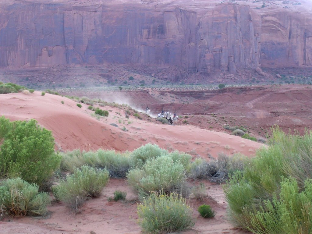
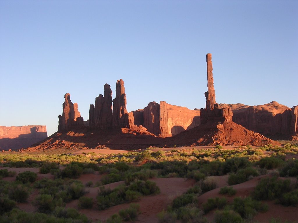
The scenery at Monument Valley Tribal Park speaks to our collective imaginary. It is as John Wayne would have liked it. The Marlboro Man must be lighting up somewhere near. We boarded a Jeep from Sacred Monument Tours to avoid driving our rental car on an unpaved road that I remember not being in the best of shape. In truth, it is quite possible to maneuver the park’s graded road – slowly. We were thinking we could have saved the money when David the driver steered us toward an area where unguided parties are not allowed. The packed dirt melted into soft sand and we bounced merrily around the imposing and monumental buttes that rise straight out the high desert floor. As we were the only two occupants of this standard-issue Jeep, David would stop wherever we wanted to shoot pictures. He told us the ruts sometimes set off the air bags in sensitive new cars. He added that some rental car companies now equip their vehicles with GPS units, the better to know they have been taken on dirt roads or across geographical areas (the entrance to the park is in Utah). Sneaky, sneaky.

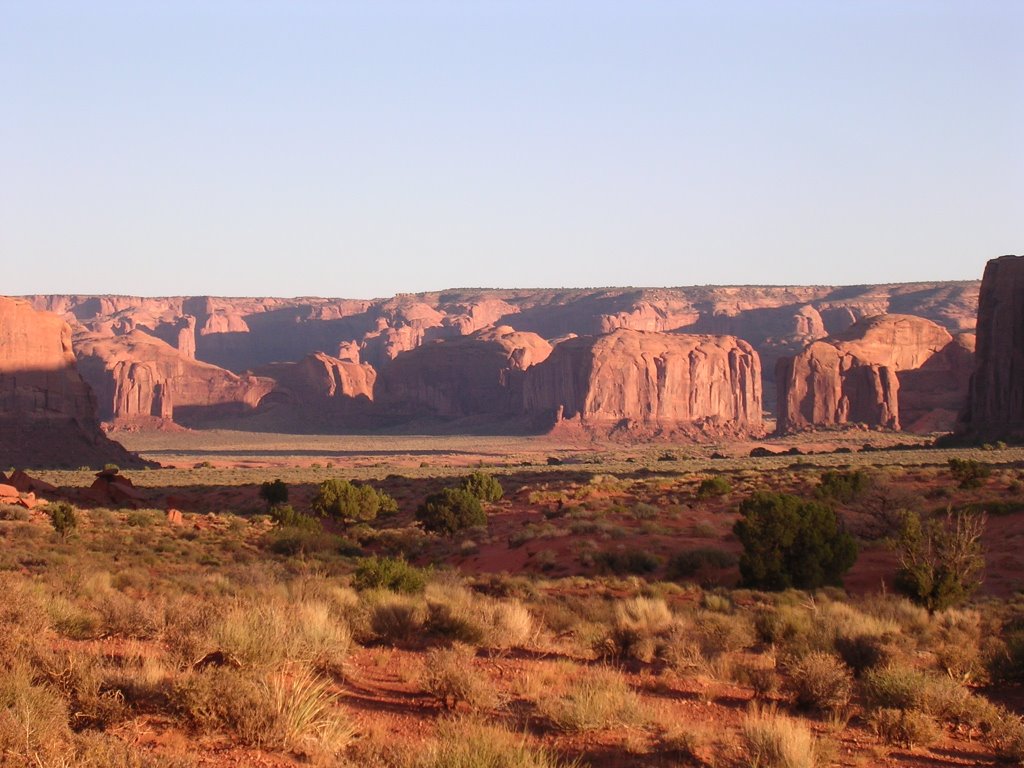
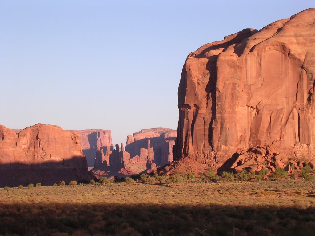
We timed our trip with the sunset and minute by passing minute the red and tan sandstone faces assumed magical dimensions. Without a seat belt (“You wear it if you want,” had said David, much to my rules-be-damned glee), I merrily bounced on the feisty road, each mile blurring the evidence of a wicked society that I resist. Even with the roar of the engine and the disjointing of our bones, we felt a serene majesty among these odd and solitary silhouettes. Each has been given an anthropomorphic name that reflects its shape or attributes: the Three Sisters, West and East Mitten, Elephant, Totem, Yeibichei.
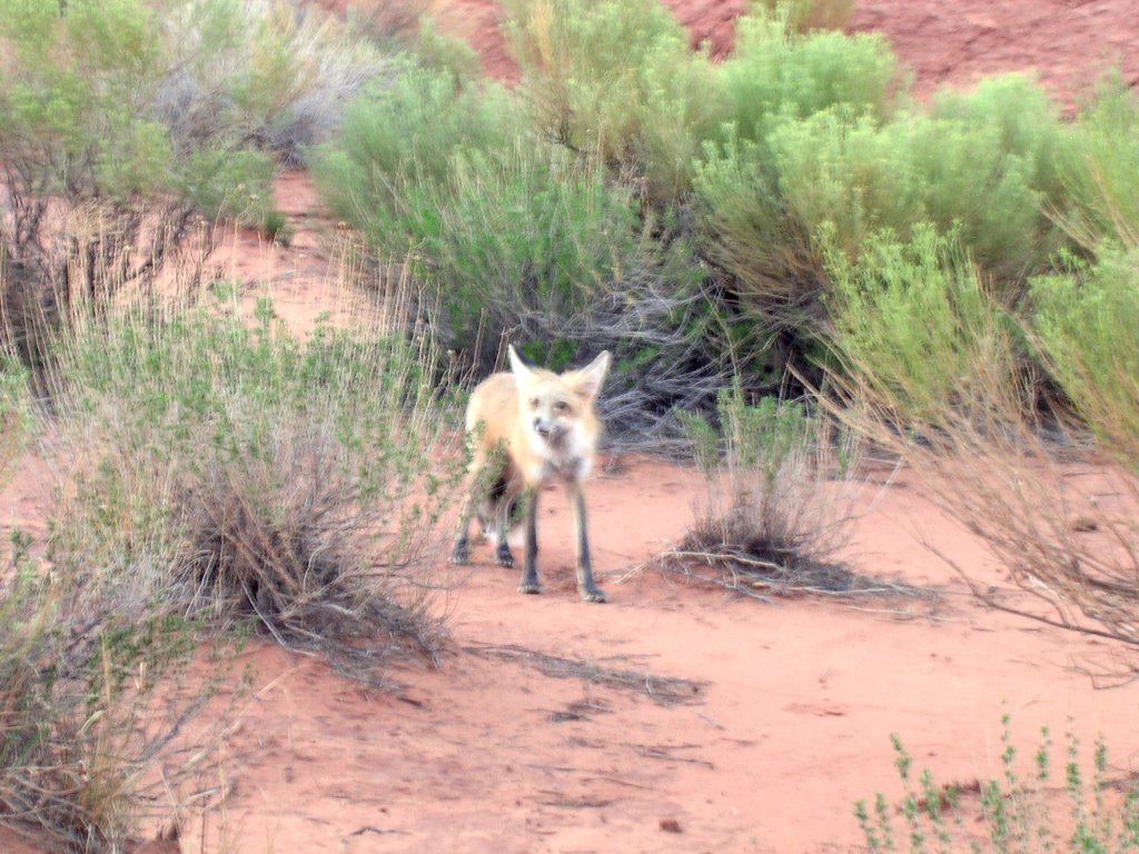
We encountered a horse party traversing a sand dune that David warned would be shooting at us Indians. I joked that being from Shonto, an isolated village that probably seldom sees a white man, I was an obvious target. I surprised him when I asked where I could get mutton stew. A fox drops by for a tentative visit.
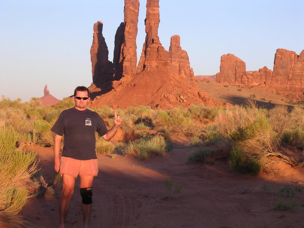
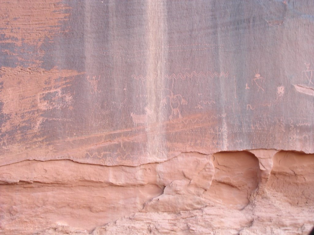
We came by natural arches formed when slabs of rock detach from the main face. We inspected cryptic ancient petroglyphs, stared at streaks of black oxidation in the red sandstone. Because several families live in the park, we saw residents returning to their home, dwarfed by the beautiful landscape. Unfortunately, we later realized Eric accidentally left behind his camera, and it was a borrowed camera, too. I became the official photographer.
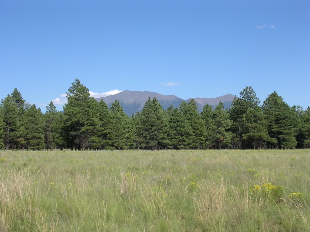
To rest our shaken bones and weary muscles, we spent the next day ambling in and around Flagstaff, an eminently pleasant city perched at 7,000 feet/2.100 meters in the middle of a ponderosa pine forest at the base of the San Francisco Peaks, a group of collapsed volcanoes visible from afar. In my cross-state trips between New Mexico and California, these landmark mountains signaled the end of the bleak small town urban sameness since Albuquerque. Flagstaff’s historic downtown houses a surprising collection of homegrown businesses in a pedestrian-friendly section, a vital counterpoint to the Route 66 collection of sagging motels and faded curio shops hawking nostalgia for a period I have never known.
We headed to Late for the Train for coffee, which we sipped at a sidewalk table, within earshot of the recurring commotion of interminable freight trains.
We ambled around downtown and I scored a free paper when a delivery person for the Arizona Daily Sun asked if I wanted one. Many stores cater to the city’s outdoor enthusiasts and students. The city itself is blessed with a network of urban foot and bike trails, but it is its propitious location that energizes active residents.
At the southern edge of the Colorado Plateau, a short distance from where it collapses into the Mogollon Rim, Flagstaff lies within minutes of innumerable exploration options. C. Hart Merriam was the first scientist to analyze and invent a classification for the life zones that traverse the equivalent of a trip from Mexico to Canada. His 1890 terminology has been refined and adapted, and his observations of the natural habitat remain accurate today. Whether you call them “Upper Sonoran” and “Arctic-Alpine” or opt for the more modern “Pinyon-Juniper Woodland” and “Alpine Tundra,” you will journey in Merriam’s footsteps as you trek between the Secret Mountain and Kachina Peaks wilderness areas, and journey from 5,000 feet/1.500 meters to above 12,000 feet/3.600 meters above Flag.
Northern Arizona University students lend a typical progressive bent, a virtuous inclination in a conservative (although not fundamentalist) state. Between campus and downtown is another conglomeration of funky shops and vibrant businesses. Neither area sports national retailers.
After a visit to the marvelous Museum of Northern Arizona (of which I was a member for many years) and its comprehensive and intelligent exhibits on Native American culture both prehistoric and contemporary, Eric and I selected the same lunch dish at the Beaver Street Brewery. When we notified the waitress our Mango Chicken Salad was disappointingly free of mango, she casually countered that indeed the restaurant had stopped serving it with the fruit several years ago. She did not see the irony and we could not resist breaking up in nervous laughter. I file her posture under abuse of language, but others may be less charitable and call it fraud. Our waitress did not find fault with the wording on the menu and offered no adjustment.
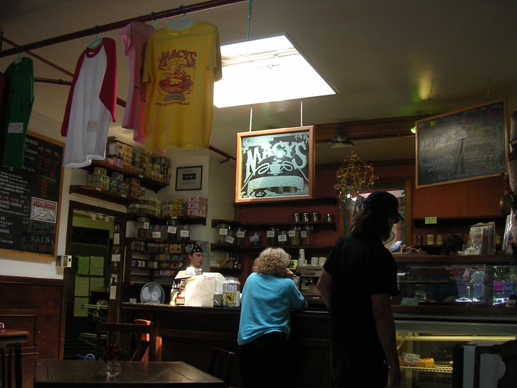
We retreated across the street to Macy’s for coffee (again!) and chocolate. This is a bohemian coffee house, and is not owned by the eponymous department store. Eric requested adjustment in the sugar content of his drink, but it was a very comfy place where I can imagine holing up during winter storms.
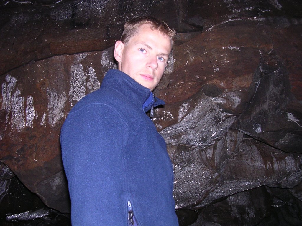
The weather inside the Lava Tube felt in fact like winter, as temperatures hover around 38°F/3°C. We fetched our jackets before further spelunking but we did not venture too far in the dark half-mile/800-meter cave, created when the crust around a flow of molten lava cooled and solidified. When underground, I am always very conscious of all the earth above me, monstrously heavy and ready to entomb...
Outside, the warm and crisp air lingered over us, and the soft light lulled us to a somnolent afternoon as we crested Schultz Pass, wedged between the San Francisco Peaks and Mount Elden. Moment and places like these impart a sense all is possible and good. We ended the day with a loop through the adjacent Wupatki and Sunset Crater national monuments, visiting a couple of Sinagua ruins and enjoying the setting light against massive lava flows that have nonetheless been colonized by grasses and trees.

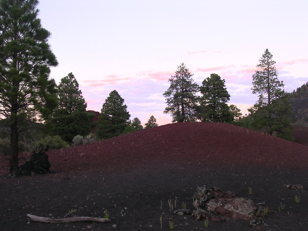
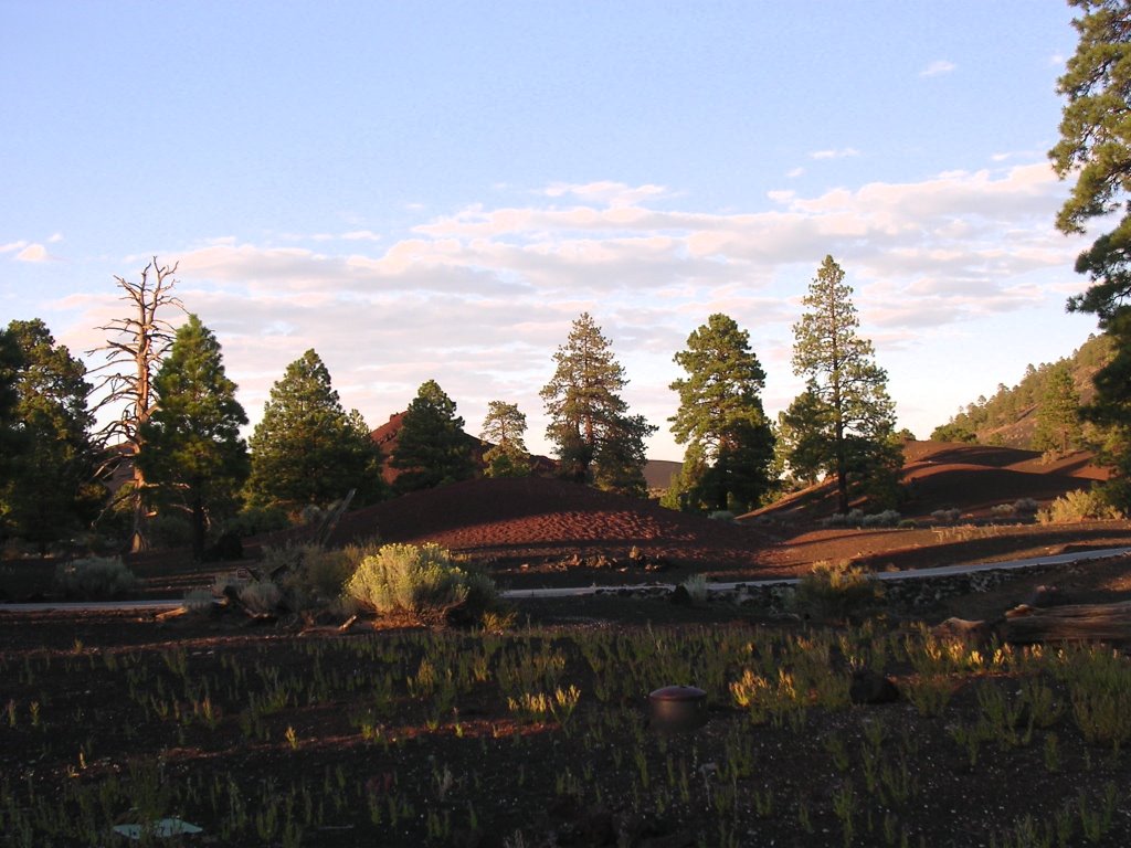
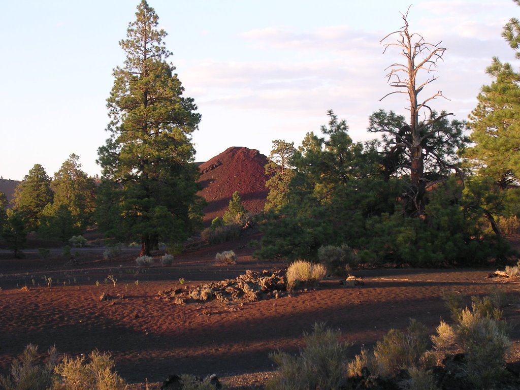
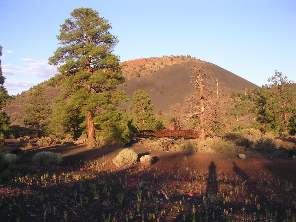
I popped a Bodington and shared it with Sunset Crater, a 900-year old cinder cone, a strikingly recent geologic event. Since my introduction to a’a and pahoehoe and watching Kilauea spew its fiery molten lava in Hawai’i, I have been drawn to upheavals. Of any sort….
For reasons unknown, Sunset Crater may not be scaled. I roped in my eagerness and looked westward and found even more motivation to climb the San Francisco Peaks the next day.
Another stop at Late for the Train, this time in Ft. Valley, and we parked the car in the lower lot of the Arizona Snowbowl ski area at 9,280 feet/2.830 meters. Guidebooks cite another trailhead near the ski area’s main lodge, but signs point to the lower lot instead, adding 240 feet/70 meters to the hike. I suspect it is to reduce usage of the upper lot by people who are not going to ride the summer chair (and who won’t pay $10.)
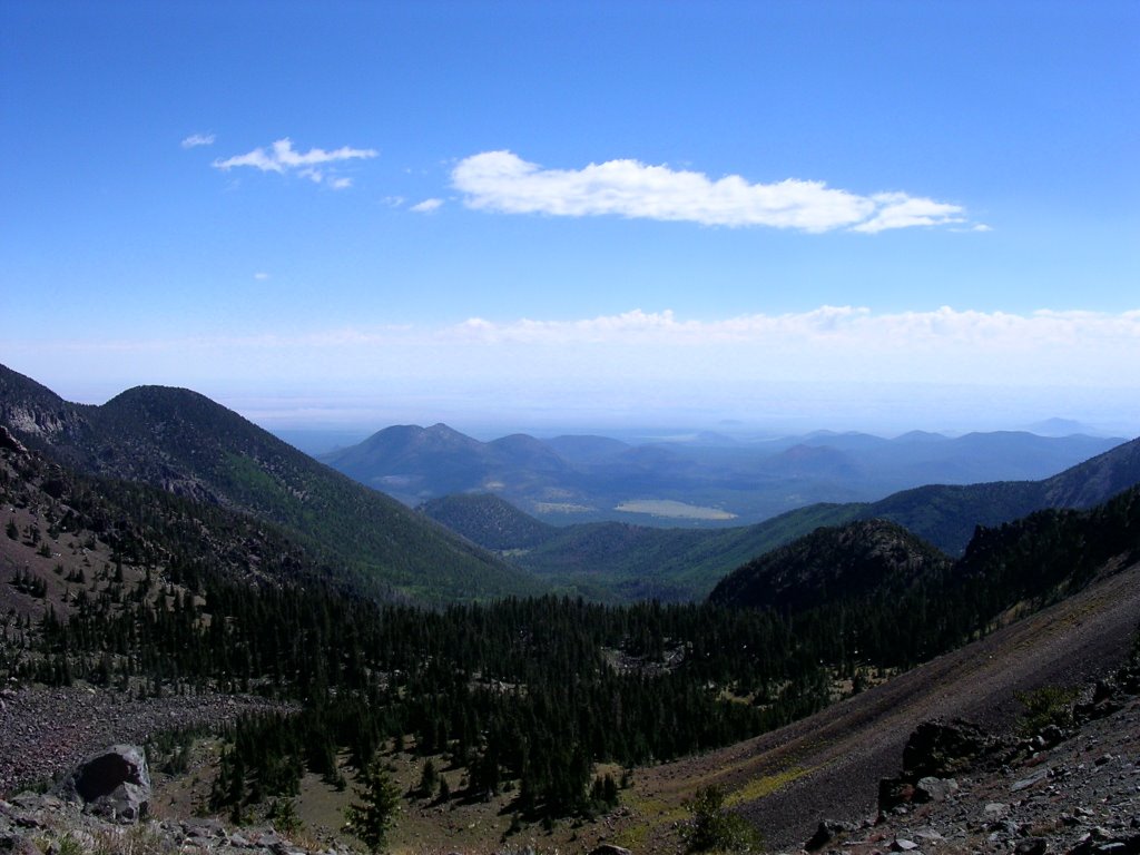
It was a bit brisk early in the morning and we both donned pants and jackets, which I complemented with a snow hat. The trail first crossed an open meadow, site of a chairlift, before entering a forest of fir and spruce. It climbs steadily but not obsessively, and switches back and forth across the south slope of Humphreys Peak. Franciscan Brothers on an excursion with Spanish conquistadors in 1629 named the mountains after their founding saint. The San Francisco Peaks consist of the remains of a collapsed volcano with three main peaks ringing the Inner Basin caldera. At 12,633 feet/3.851 meters, Humphreys Peak bests the other two, Agassiz and Fremont, by a few hundred feet. I often refer to it as Kachina Peak, only because all three summits lie within the Kachina Peaks Wilderness, but there is no such mountain.
After the third switchback, I performed a small ceremony to welcome Eric to a landmark elevation. He had never been this high, and I administered the proper rites mandated for the first passing of 10,000 feet (which sounds more significant than 3.048 meters).
I also checked my pulse. It has been determined by our great medical authorities that I have a slightly elevated high-blood pressure. It has also been noticed that my four uncles and grand dad all died of a heart attack. I am a little perplexed by this background because I am quite physically active and fit, and eat a varied diet. On the way to the summit of Mount San Jacinto above Palm Springs, Calif., a few weeks ago, I stopped at 10,000 feet and surveyed my heartbeat. It was 128 then, and 120 today, measurements I am told are sensibly below where they are normally when exercising at this altitude. My heart does not exert itself unduly. Ultimately, a heart attack may be preferably over more agonizing options, uh?
(The trip to Mount San Jacinto was fun. I stayed with my friend Grant in Palm Springs, went to a water park. Returning home, I biked around the Snow Summit ski area above Big Bear Lake. Around and not in it. Even though they transport biker and bike up the hill, management prevents you from riding down on the ski area’s trails and instead directs people to forest service dirt roads. I swear, there will be a day when skiing will no longer be acceptable, for our safety, at a ski resort! To recuperate, I chose a cup of coffee – I should start drinking booze instead – and met Andrew, a friendly dude, a recent transplant to Big Bear, but who grew up outside Gatineau, Québec. We shared stories!)
Every now and then, Agassiz Peak would come into view, chairlift and all, and I daydreamed of skiing. I believe, in fact, that I did visit the Snowbowl once, but the details are somewhat hazy. Its trail map reveals a small area, but with a decent 2,300-foot/700-meter vertical drop and what I imagine as good off-piste investigation possibilities.

Eric got warm and peeled off the top layer. True to form, I remained bundled. We crested the saddle at 11,660feet/3.554 meters and peered into the Inner Basin immediately below. I fantasized about what the landscape will look like mid-October when the considerable aspen grove would turn a golden yellow and blanket the sheltered bowl. We chatted with an older couple recently retired to Sedona from the East Coast. She warned the remainder of the trail was very steep and declined to join her alpha male in the pursuit.
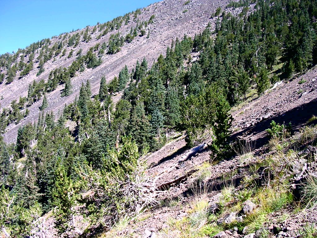
I dropped my fanny pack and we continued on the final stretch, less than a mile but twice as steep as what preceded. Stunted trees quickly surrendered to the harsh climate of the tundra. Precipitation, which falls mostly as snow, is never too great near mountaintops. Howling winds blast any settled accumulation. Mere inches collect on exposed ridges and summits, whereas dozens of feet of snow may carpet the slopes below. Cornices will develop on the lee side, a highly unstable snow pack. I saw a map from the local avalanche center that shows slides have fractured slabs all around Humphreys.
But that sort of stuff turns me on. Twice we were duped by deception peaks, when the summit appears near only to be revealed as farther away. The air is thin and solar radiation great. We stepped across rock fields, our giddy heads in a sky littered with lumpy clouds.
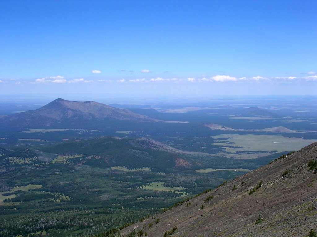
That it is the state’s tallest mountain is not fully consequential as we feel on top of the world. The plateaus that surround us form the moat around our island in the sky. Mountaineering awakens primal urges and passions, as if each step liberated us from trivial earthbound preoccupations and recalibrated our senses and priorities. I have likened it to intoxication: It is a compulsion that yanks me regularly from my beach town home. I love the delirious intensity. Let flatlanders dwell in murky circumstances – of their own making.
I decided to strangle Eric.
No wonder then that Dook’o’ooslííd is sacred to the Navajos, as Nuvatukaovi is to the Hopis. Although not on a reservation, tribes have petitioned the government often and joined environmental groups in lawsuits to oppose development.
The ski area has applied for permission to use reclaimed wastewater for snowmaking as part of a modest expansion plan. Their rationale hinges on ensuring a more reliable snow cover to attract skiers in years of nominal snowfall and on offering more amenities to visitors. The Save the Peaks coalition argues that spraying tainted water cannot be an option. The Hopi, Hualapai, Havasupai, Navajo, Kaibab-Paiute, Yavapai-Apache, Salt River Pima, San Carlos Apache, Zuni Pueblo and Ácoma Pueblo nations invoke an assault on cultural identity and integrity.
Vocal protests often surface, led by well-meaning folks who, nevertheless, have a direct stake in the matter. It is not altruism alone that sometimes compels activism. When the personal benefit of opposition recedes, high mindedness subsides.
Environmentalists come, by and large, in shades of pale white, and most typically of the refined variety, save for college students. The 13 tribes who have filed amicus briefs against Snowbowl are not among the privileged and influential. They are not white. More critically, they oppose a plan that does not affect them directly, as the peaks are but a distant landmark for most.
How often do municipal or state governments organize resistance to development? When they do, it is typically when there is no potential economic gain. At the grass-root level, I am often confounded by the pious desire to protect and the unwillingness to sacrifice. Several years ago in (enlightened) Santa Barbara, many groups pointed to our unhealthy creeks and cried foul. Instead of using property taxes to clean them up or find other local funding, we passed an initiative that increased the hotel tax on visitors – people who do not vote here and who have a de facto limited enjoyment of said creeks – by 20 percent. This is hypocritical.
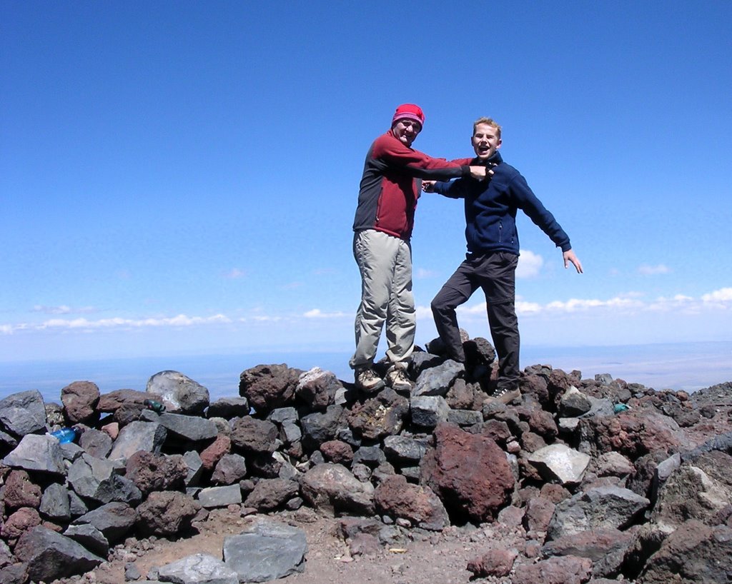
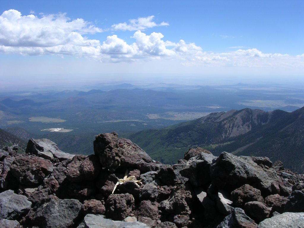
At the summit, I filled out the registry by describing the atrocious ascent in a fierce blizzard with a near loss of life. Now that the storm had passed, I made out NAU’s campus in Flag, countless volcanoes, and a substantial hole in the earth to the north. I enlisted the Sedona man to record the moment with beautiful pictures of us. A prayer bundle reminded me of this mountain’s religious significance. On many occasions I have had the privilege to attend Native American ceremonies, from social pow wows to spiritual rituals. Over dinner back in Tuba City, I had read in the Navajo Times that this year’s snake dance on the Hopi rez would not be open to non-Indians (visitors tend to treat those events as entertainment). Even though it was scheduled for the previous week and I could not have attended it, I longed to immerse myself in the rhythms of an Apache kinaalda and a Zuni shalako.
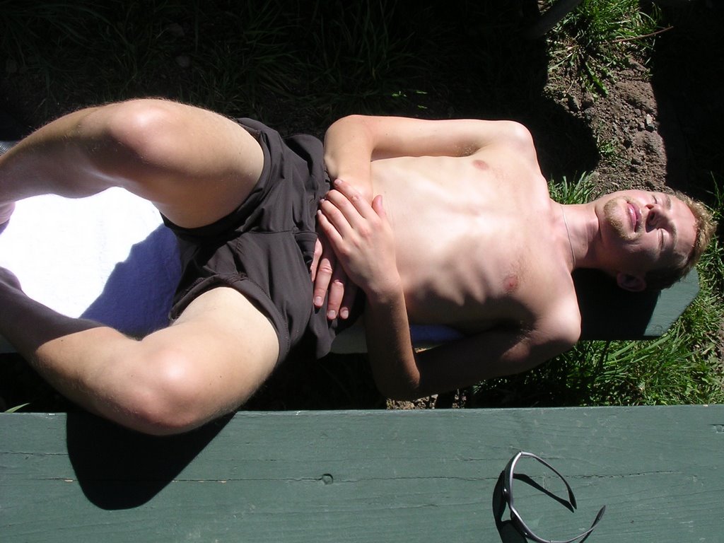
We flew back down with an eye toward avoiding unnecessary lightning and thunderstorms for a lunch stop at the saddle where we met the Sedona couple, whom I started to believe wanted to homestead the spot, once more. We checked out Snowbowl’s base lodge and sat at an outside picnic table, mindful not to drink alcohol as it was “strictly prohibited.” Eric let the soft air induce him to a state of unconsciousness and I snapped a picture of him half naked. I would have posted an even better picture of him walking down a ski trail enveloped in a white bath towel but I laughed too hard and did not think of taking one.

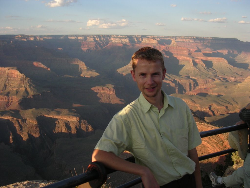
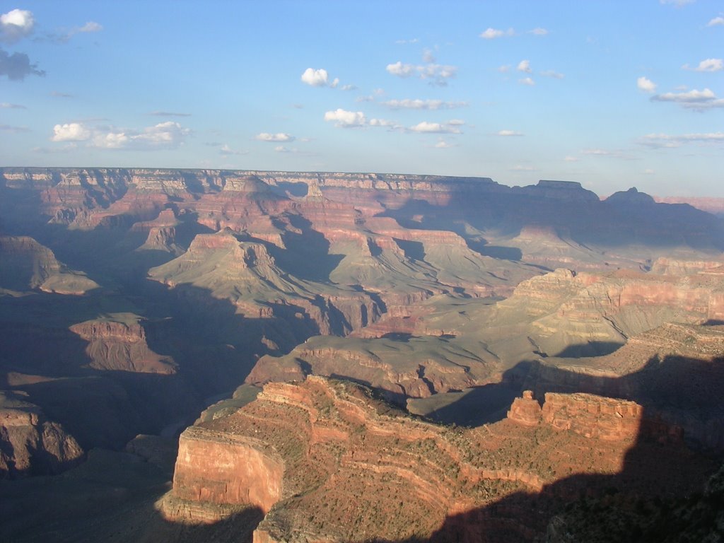
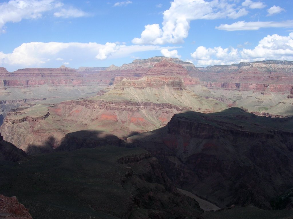
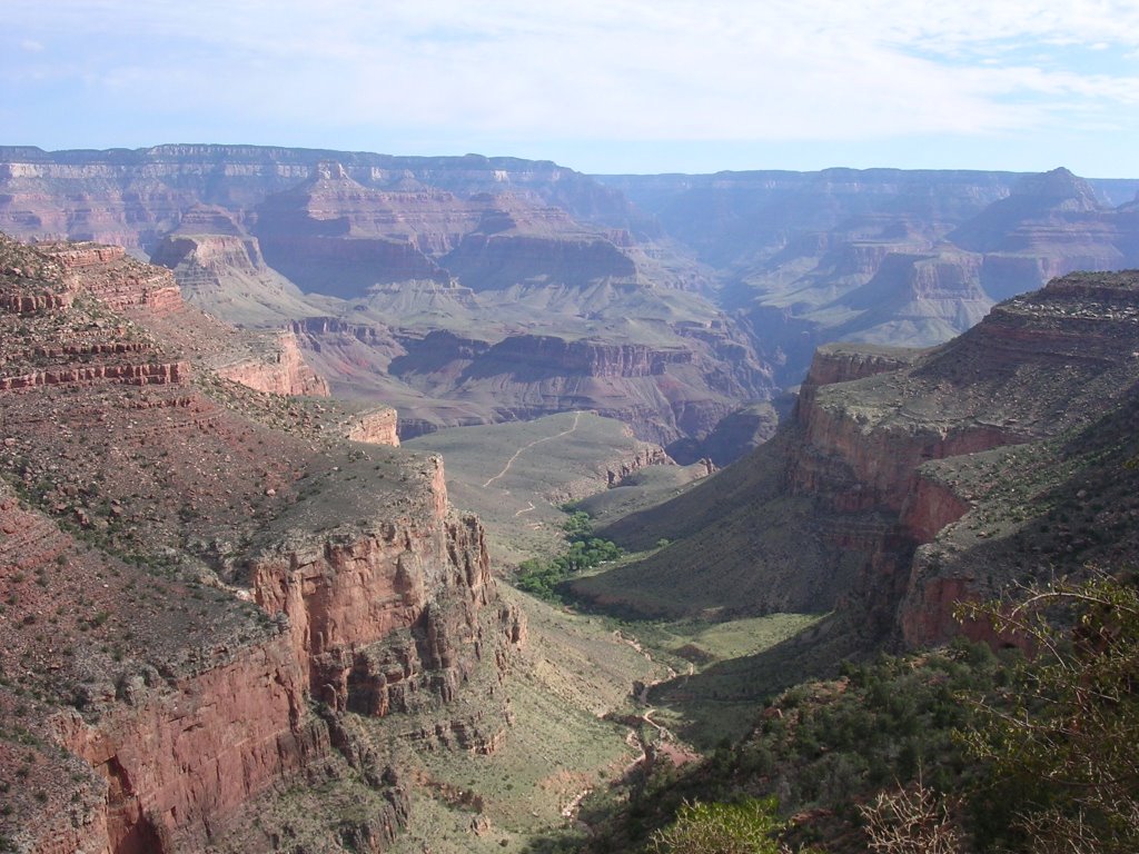
An hour later, I steered the car excitedly to the brink of the giant chasm of Grand Canyon National Park. Without any advance warning, the earth split open before us.
“Oh, wow,” was all Eric managed to say. It was plenty.
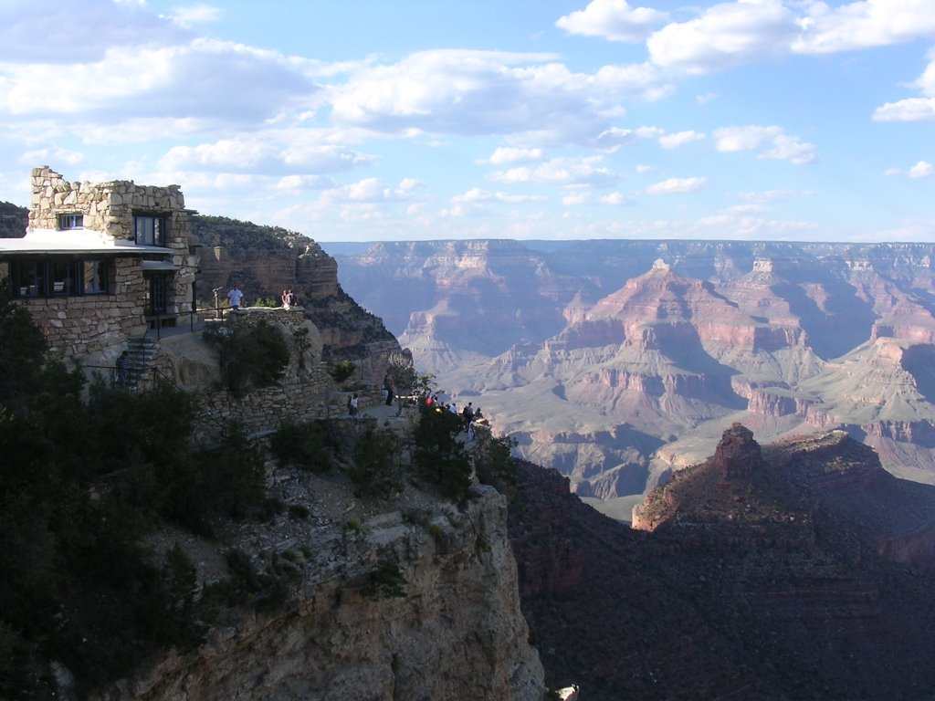
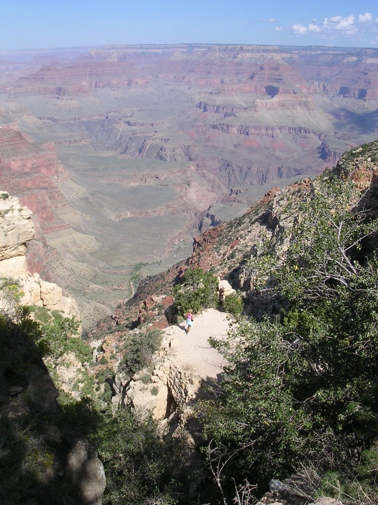
We checked in at the Bright Angel Lodge and collected our meal tickets for our trip to Phantom Ranch. Eager to explore, we tried to take in the complexities of the three public shuttles. It was difficult to plan our many desires, weighing shuttle times, visitor center hours, and sunset. We walked a few feet over to the Kolb Studio at the head of the Bright Angel trail, and absorbed as best we could the enormity of our undertaking. This would be our return trail and while we planned on an early departure from Phantom Ranch, we were glad to notice the trail from Indian Gardens up was in the shade at this time of day.
We hopped on the Hermits Rest shuttle (the road is closed to vehicles in summer) and after listening to the continuous narrative from the driver, assented to his recommendation that Hopi Point was the place for sunset. “Doors are about to open,” he would say prophetically, only to follow with an unsurprising “doors are opening now.” He played us his rendition of elevator music while he would let enough time elapse for the slowest human beings on the planet emerge from the bus before yapping “doors are about to close” at each stop.
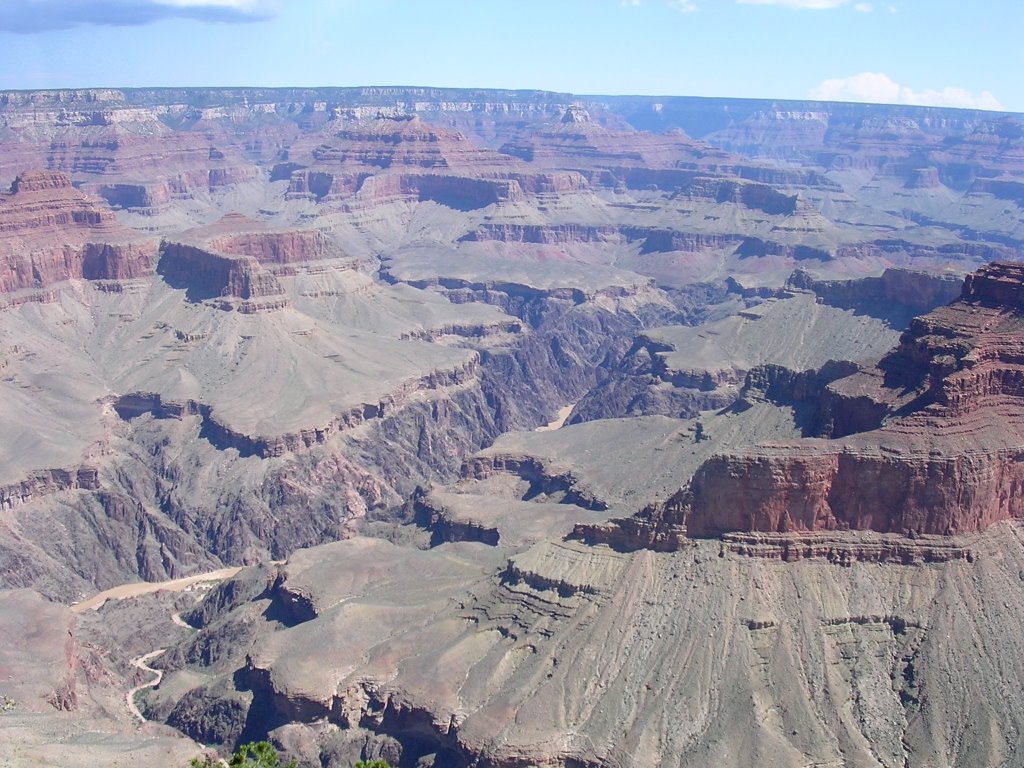
The sinking sun slowly washed over millions of years’ worth of rocks and colored them ocher, orange, pink, red, chocolate and purple. The spectacle easily shelved the driver’s cloying narrative. I chatted with a television writer from Toronto on his way back cross-country after a conference in Los Angeles. English was not in the majority as the park attracts a great many visitors from around the planet. We felt like one small community on the edge of the world.


At once, we dismissed the prospect of taking the Hikers’ Express to bring us to the South Kaibab trailhead at Yaki Point. In spite of the dire warnings about not hiking during the heat of the day, we reasoned we would be walking downhill, and that we could safely cover the 7 miles/11¼ km to Phantom Ranch in three hours, not the four to six rangers advise. We were not particularly impressed with the 4 a.m., 5 a.m. and 6 a.m. departures.
By the time we showered, had breakfast, checked out, rode the blue shuttle to the Market Plaza for fruits, then again to the Canyon View Information Plaza to transfer to the green bus, it was a few minutes before 10 when we showed up at the trailhead.
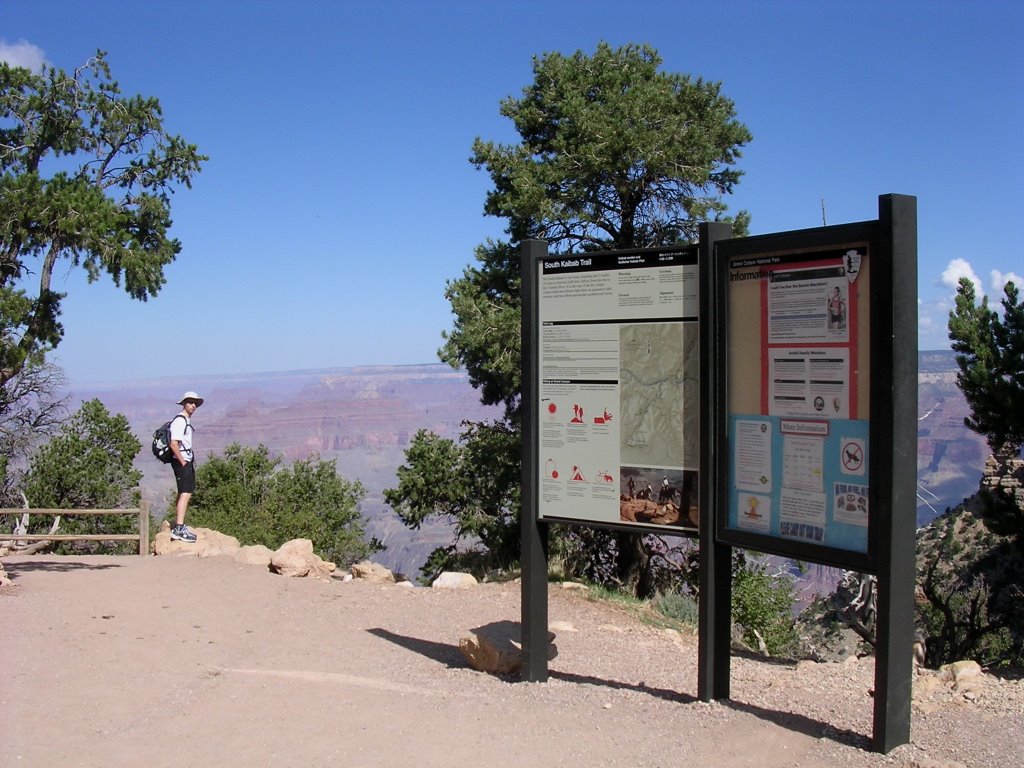
The South Kaibab trail presents several advantages for hikers going all the way to the Colorado River, traveling from woodlands to desert.
It has no shade and no water, and is steep. Great benefits, no?
The strategy prescribes that it is preferable to hike down this trail, and up the longer but less steep Bright Angel that has shade and water. Who can argue with that? The Park Service built the South Kaibab trail in 1925 when it could not wrest control of the Bright Angel trail from Coconino County, which was charging hikers and riders a toll to travel to Phantom Ranch.
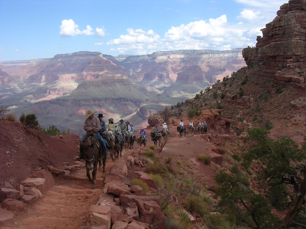
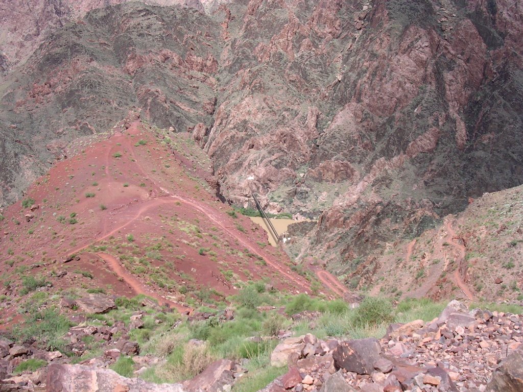
We dropped eagerly into the Chimney, a series of tight switchbacks, beginning our downward trek to the Colorado River 4,740 feet/1.455 meters below. Soon, we joined a French couple from Nice who were a bit incredulous as to our destination. We reached Cedar Ridge at first confused that we ought to be at Ooh Aah Point. A ranger told us we had already passed it and didn’t notice the sign as it had probably been taken away as a souvenir. I have no memory of meeting a ranger on a trail in the last 10 years. Several times, we paused to the side to let wranglers lead pack mules and tourist riders back up from Phantom Ranch.
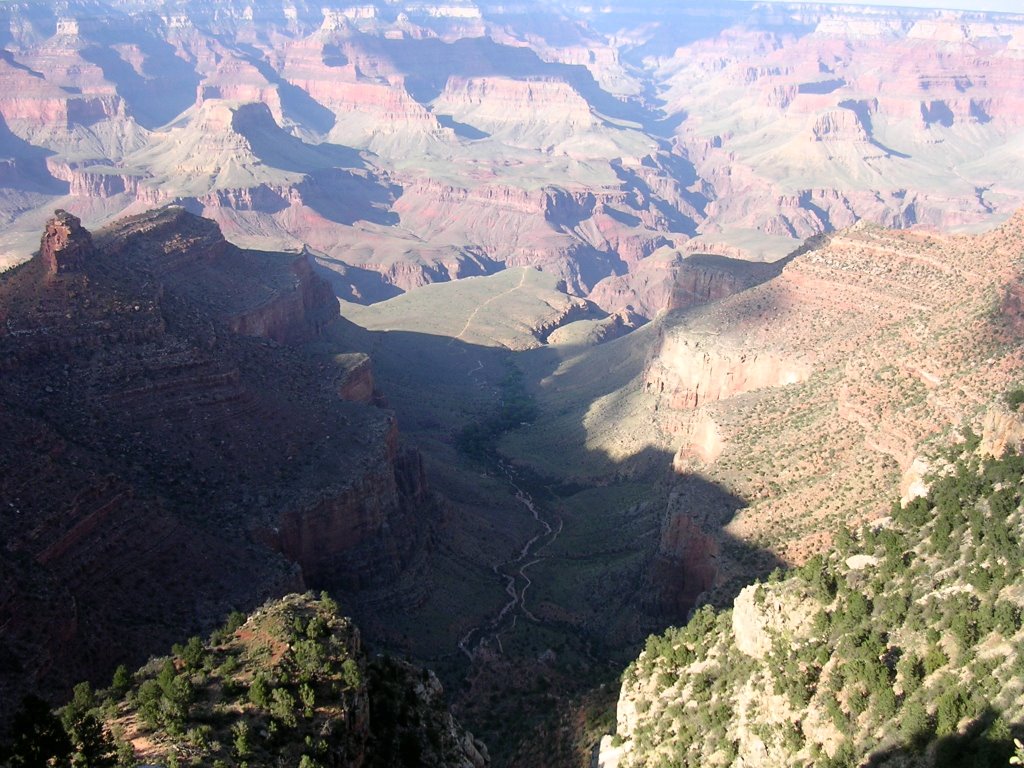
Past O’Neill Butte, the trail levels off as it skirts Skeleton Mesa, named after the remains of pack mules that fell off the cliff. For the first time, we spotted the Colorado River and the lushness of Phantom Ranch on its right bank. Below the rim, the earth collapses in incremental steps and the river is seldom visible from the top. Even though we were 2,800 feet/850 meters above it, we could pick up the roar of the rapids.

The Grand Canyon nomenclature dips into world religions, with an obvious nod to Eastern philosophies. Buddha Temple, Hindu Amphitheater, Krishna Shrine, Zoroaster Temple, Rama Shrine, and Brahma Temple stand proudly in the inner sanctum, an affirmation that has to distress the Christian fundamentalist crowd that pressured the park service to include references to biblical creation in geology displays a few years back.
Notwithstanding the three quarters of American who believe the earth was created in six days, our trip into the bowels of the Grand Canyon travels through eons of geological time.
Each exposed layer of rock reveals a period of time. By hiking down to the river, we wind back the evolutionary clock 1.84 billion years and descend almost halfway to the origin of the earth. The uppermost Kaibab Formation atop both rims preserves the youngest rocks, a limestone that is 250 million years old. Travel northward to Zion National Park and the Kaibab Formation lies now at the bottom, under the Virgin River bed. The Carmel Formation, the park’s youngest and uppermost layer, becomes, in turn, Bryce Canyon National Park’s oldest. The progression adheres to a stairway continuum. Think of the Grand Canyon as the grand parents, Zion as the parents, and Bryce as the siblings.
The width from rim to river is far greater on the north side. Water from rain flows southward when it falls on the slightly tilted plateau. On the North Rim, it flows toward the Colorado River and erodes the canyon, whereas it flows away from both on the South Rim.
We watched what would be the day’s last hikers come up though the Red and White, an allusion to iron oxidation of the normally grayish limestone. Hiking toward the river is akin to hiking southward toward the desert. Yuccas and prickly pear cactus dominate the landscape. The heat bore down on us, and even more so on the rare souls hiking up. The exposed rock faces refract the sun’s heat, and the narrowing of the canyon walls holds it in. The very still air temperature may be 95°F/35°C, but it feels much warmer in the oven near the bottom of the earth.

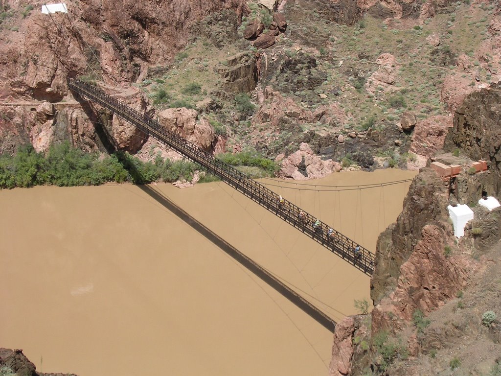
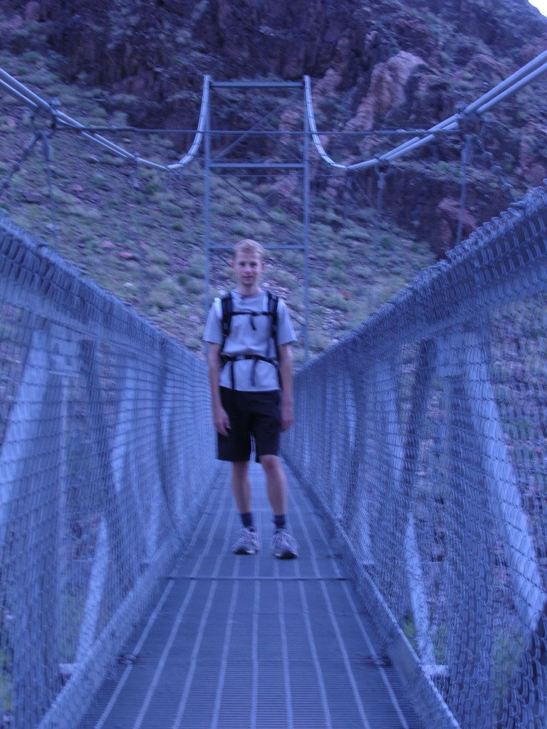
The junction with the Tonto trail marked our arrival at the Tip Off. For 92 miles/148 km, it parallels the river high on a plateau. We now encountered the black metamorphic schists, gneisses and granites of the Vishnu Group that date back 1.7 billion years. We are in the Inner Gorge. With each impossibly steep step toward the river our toes jam hard against our boots. The searing heat cannot suppress our exhilaration when we spot the Suspension Bridge. We unite with the primeval moods of the landscape.


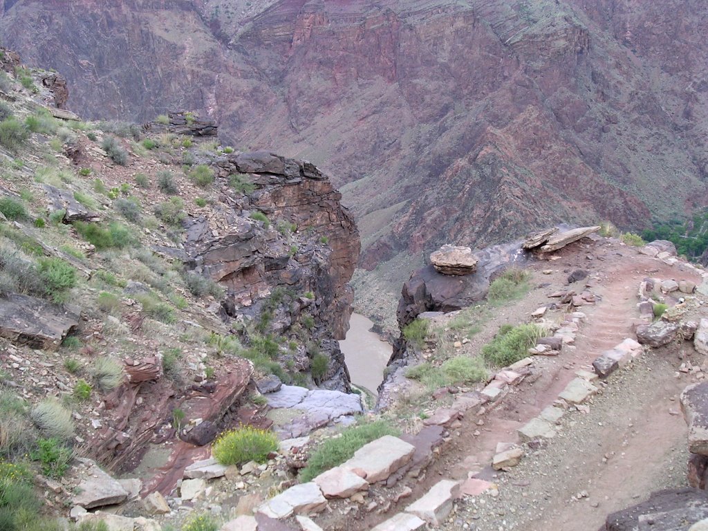

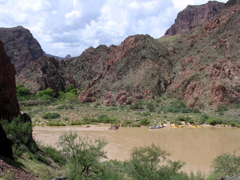
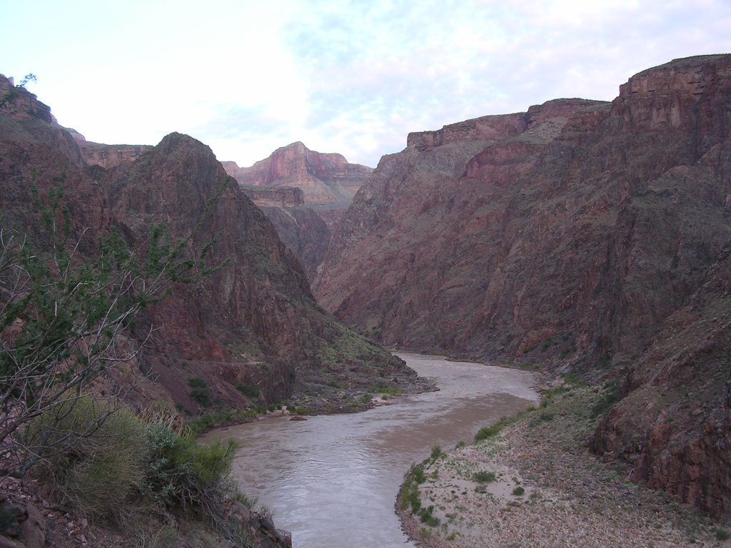
We ford the mighty Colorado, a slumberous coffee lifeline gorged with silt and sediment runoff from the week’s thunderstorms. The river is wider than I imagined it would be. A group of rafters had landed at a small beach and I asked if they wouldn’t mind giving me a ride. They retort that I have no idea what I would be getting into, something that becomes clear when I realize a lot of the participants are in wheelchairs. At this stage, they have been on the river for five days since putting in at Lees Ferry below Glen Canyon Dam at Lake Powell. They have floated 87 miles/140 km to beach at Phantom Ranch, the first possibility to bail out – if you hike or ride out. The first road access and traditional put out is at Diamond Creek, 277 miles/446 km and 12 days on an oar trip downstream from Lees Ferry. Along the way are major rapids, many rated 4+, even 5. I have rafted down 4+ drops and it is not for the squeamish. The Colorado throws one after another.
It takes about two weeks to churn a small segment of the waters John Wesley Powell charted in 1869. To say that such a trip would be memorable is an understatement. Thousands ply the river every year, but they have more in common with themselves than with me. The adventure costs $2,500-$3,000, and even if you reduce it to a daily rate of $200 or so, it is still far too rich for my blood.
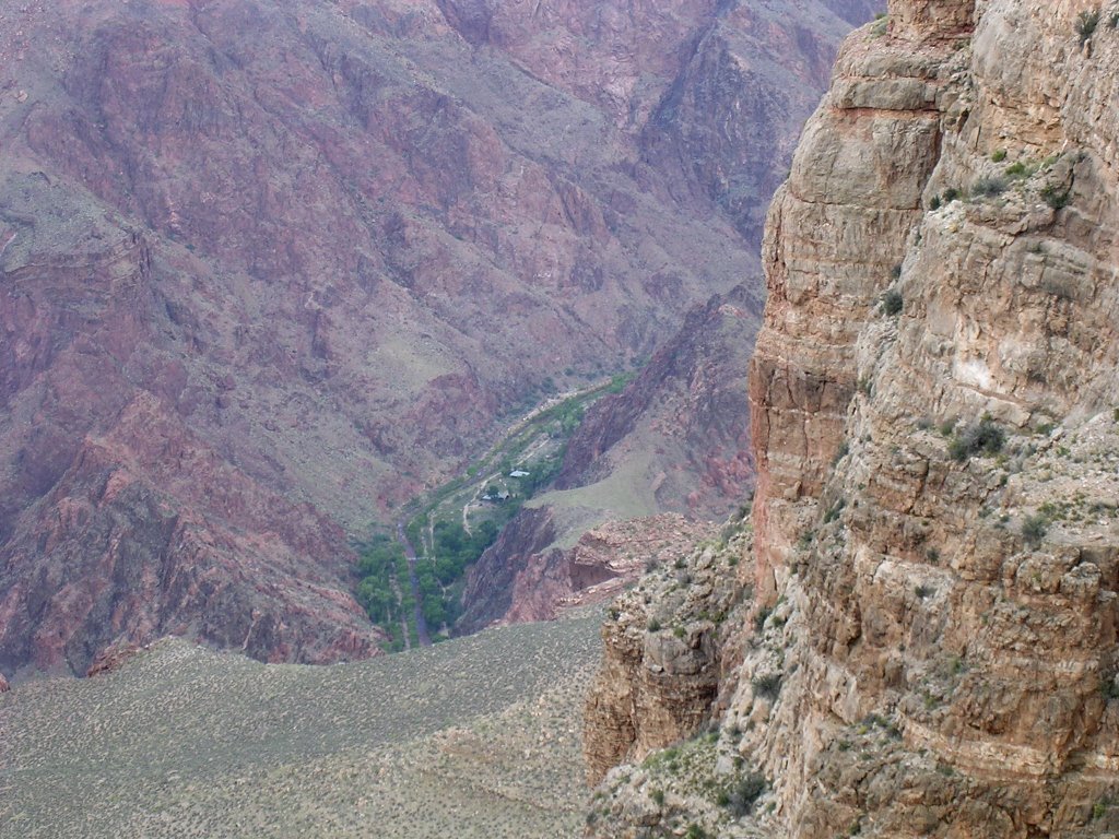
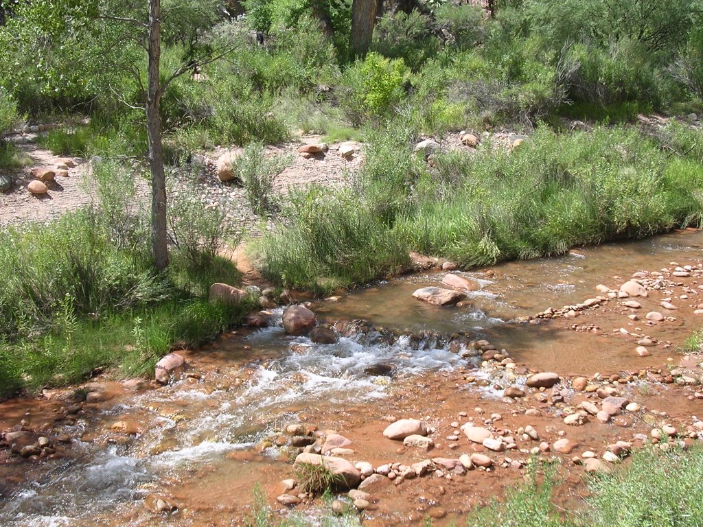
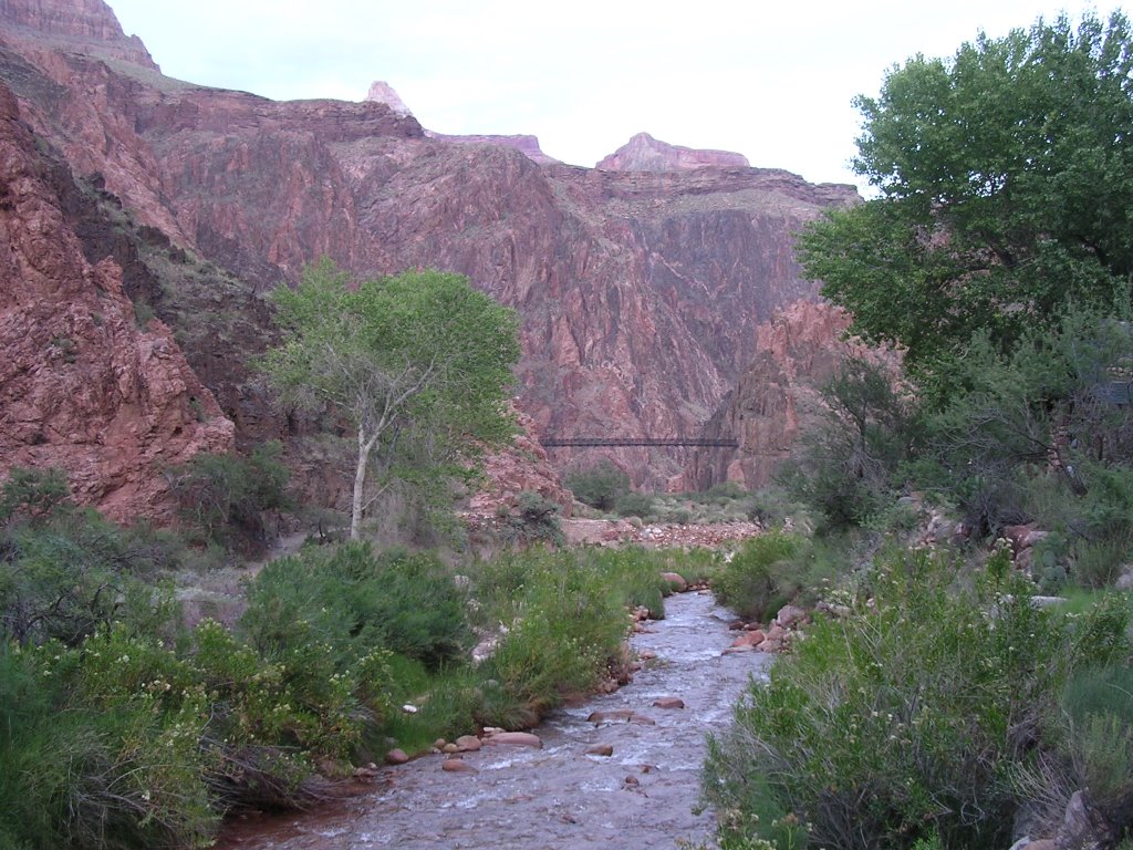
Phantom Ranch lies another half-mile/eight hundred meters away, a tease but seemingly far. I expected a forlorn building or two. It is more like a small village in a verdant riparian habitat on the bank of year-round Bright Angel Creek, which we wasted no time to dip in. The water was cold, but I will admit, mightily refreshing in the ambient 104°F/40°C heat.
Most hikers reach the ranch the way we did, but a few hike down the North Kaibab trail from the North Rim for a one-way, through hike. I had originally planned such a trip but logistics intervened.
We met a German visitor in our dorm. He had hiked down in borrowed boots that he wore for the first time and, not unexpectedly, developed a serious blister. Rangers advised to duct tape his foot but warned that the skin would come off when he peeled the tape later. The trip down took three hours and we relaxed the afternoon away, writing postcards that would be brought up to a post office by mule, and chatting with other hikers. Eric picked up an apple (75¢) and I a Tecate beer ($3.50) from the canteen, at prices we found very reasonable. For a brief interlude, a few drops of rain from thunderclouds far above finished their journey on the canyon floor, unleashing the fragrant desert scent.
The ranch consists of two male and female 10-person dorms, several cabins, a canteen and dinning common, a campground (watched over by a pair of wild turkeys) and a ranger station. A maximum of 180 people can be accommodated overnight, with no more than 20 being mule riders, the rangers said. Their post comes equipped like a miniature emergency room, complete with defibrillator. Helicopters can land nearby to evacuate seriously ill hikers.
At 4 p.m., 30 of us joined Ranger Amy for a game of Jeopardy in the shade of the cottonwoods. Plants, animals, history, geology and potpourri made up the five categories. Correct answers needed, of course, to be framed in the form of a question, or would meet with the rejection of an ominous buzz. Ranger Amy doled out prizes that included a plain bookmark, a color bookmark and a sticker cautioning against feeding wildlife. Seeing that the plain bookmark got few takers, she progressively added spin to her praise and ending up describing it as a rare collectible.
With a few other victorious contestants, I was invited to Final Jeopardy. Three of us answered in unison who had been the first man to raft the Colorado, prompting another clue to crown a winner.
“She had been the architect of several buildings on the South Rim when she was commissioned to built Phantom Ranch,” advanced Ranger Amy.
“Colter,” I screamed.
“Uh, who was Colter,” I quickly added.
“Mary!”
And with that I received a waterproof topo map of the park.
The ranger program ended just as the dinner bell tolled. We shared a convivial meal with fellow hikers and traded stories. The de facto hostess of our table was a woman who accompanied her husband on their second trip. This time, they dragged their two sons, ages 11 and 14, on the adventure.
In our many joyful conversations that day, we heard about the 80-year-old man who had been seen on his 80th trip down.
I spoke with a retired couple from Minnesota who had motored west (possibly on the highway that’s the best) in their mobile home and taken a job last fall in a gift shop at the Desert View entrance to the park. It was their 12th trip down.
Matt was on his first trip west from Massachusetts and marveled at all the amazing scenery he was drinking in. At 25, he was just embarking on a two-year trip around the world that would take him to Asia in late September. After that, he wants to put his MBA training to work for Oxfam, an NGO that views poverty as an injustice. More power to you, Matt! On his bed, he meticulously kept eight empties that he would fill with water for the trip up.
There was a man who drank a lot of Tecate. He looked rugged, unshaven. He knew all the side trails in the canyon.
Another from Canada looked like Yul Brynner and sounded Polish.
Seatmates to my left, an Indian couple from Downey, Calif., also had inspiring stories to tell. Everyone was in a superb mood, possibly because no one had done the hard part yet. Still, a common purpose united us and this could have been a summer camp.
Brooks, our server who would act as cook the following day and as dishwasher the one after that, treated us kindly and amicably. I found no fault with the garden salad (mercifully free of iceberg lettuce), the juicy New York steak, baked potato and mixed vegetable, cornbread and cake.
Owning to its location inside the earth, there is no radio reception or cable hook-up. When someone asked what he does for fun, Brooks said that he subscribes to Netflix (a DVD rental service by mail). He relies on the mules to bring in new movies and to ship them back out: a perfect marriage of the old and the new. He has been working at the bottom of the Grand Canyon for five consecutive years.
I strolled back to the river and met Matt who was hoping for a nice sunset but we strained our neck to catch its last rays on the rocks far above us. At the beach, we dipped our toes in the cold Colorado and we stumbled on a Kansas couple enjoying the twilight. They said they tried for many years to obtain a private permit to run the river, finally scoring one after 12 years. This bypasses commercial outfitters, but imply the availability of a raft, and the knowledge to run the rapids. By then, unfortunately, the boat owner had gone blind and thus was no longer in a position to guide them. A few years ago, the park service issued a moratorium on new registrations as the wailing list had passed 8,000. Next year, they will double the number of annual permits to 500, but the increase affects winter trips only. (A Flag outfitter can set you up with a raft, supplies and food, and shuttle service, for a flat $17,000 fee for two weeks.)
Nighttime fell and a ranger program on geology began. It was soon interrupted by the loud roar of a helicopter hovering above us, giving rise to speculation of what evacuation might be under way. But it never did land. On duty again – rangers assume an eight-day tour – Ranger Amy resumed the Grand Canyon’s geologic timescale to D-U-D-E: deposition, uplift, down cutting and erosion. Short and sweet.
Afterwards, we ambled around in the dark with black-light flashlights to identify scorpions. Almost impossible to spot with a standard flashlight, the black light rendered the critters phosphorescent and eerily visible all around us.
With visions of two dozens or so scorpions, we hit the sack, not before a concerned Matt had Ranger Amy inspect our dorm. In the middle of the night, Eric felt motions that he attributed to the restless 14-year old hiker on the above bunk. I felt them, too, and my upstairs bunk was vacant. I pictured an earthquake, with tons of rocks tumbling and crushing Phantom Ranch and its people. It was not too implausible as we were sleeping atop the Bright Angel fault line!
“Five o’clock breakfast call,” the person who woke us up announced twice until she heard a plaintive acknowledgement.
I freshened up and got dressed, less tired that I would expect at 4:30 a.m. Other than Eric, no one stirred in our dorm as the blistered German, the dad and his two sons, Matt and a late arrival, all would breakfast at the second 6 a.m. sitting.
The excitement of the hike ahead lifted the conversation around the dinning table. Especially for a 30-something couple from New York City. Having missed their flight earlier the previous day, they arrived late in Phoenix, and it was late afternoon as they pulled into the park on the South Rim. Halfway down the South Kaibab they flipped their flashlights on to navigate the darkness. Two hours later, the batteries died and they finished the hike without a source of light. They got to bed around 10 p.m. and were getting ready for the hike out in order to make it to a wedding that afternoon.
No pressure!
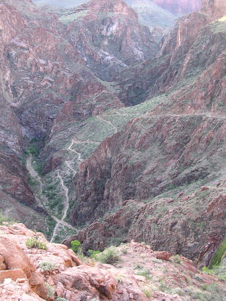
We walked on the Silver Bridge above the Colorado River and bade a bittersweet farewell to Phantom Ranch. It was already light and 70°F/22°C at 5:45 a.m. We had 9.6 miles/15½ km and 4,320 feet/1.317 meters ahead of us, but the River trail starts gently as it hugs the river before veering inland and uphill at the Pipe Creek confluence and being rechristened Bright Angel.
The calm before the storm, if you will.
The entry into the Pipe Creek drainage swiftly ups the stakes. As we labor up the Devil’s Corkscrew, a twisted affair that requires no description, we still benefit from the shade afforded by the massive gneiss rock faces. We have passed all the parties that had left before us. Beyond the waterfall, the sun begins to filter through the morning haze, but in the Tapeats Narrows, the luxuriant Garden Creek shelters us from its direct assault. The presence of water refreshes, even unseen.
Just before Indian Gardens, the halfway point, we meet the first downhill hiker of the day, a German woman who left at 5:30. We exchange encouraging words, and assign her the “Number 1” title.
During a short break in the shade of this delightful spot, we try to calculate our progress. She took 1¾ hour to hike 4.6 miles/7.4 km. We spent 1½ hour to cover 5 miles/8 km uphill. It is happenin’!
From Indian Gardens up, we knew water would be available every mile and a half. This stimulated me to drink my own supply, to lighten my load. I hauled a liter and a half of water, two small bottles of Traderade, and an empty one filled with water at Phantom Ranch. Traderade is the name Trader Joes gives its sports drink. Even for someone like me usually associated with lizards and camels, it is vital to drink water on such an expedition, but water itself will not replenish depleted electrolytes, a blood substance that helps regulate the proper balance of body fluids. Sodium is an example of electrolyte, and salt does the trick, albeit with an unpleasant taste. I prefer a flavored sports drink, cautioning that most such beverages contain high fructose corn syrup (the artificial sweetener of choice in the U.S.) and thus ought to be avoided. Traderade is a knock off of Gatorade. Both (but not Powerade) mirror orange juice with sucrose (simple sugar made from cane or beets), fructose and glucose (both fruit sugars that differ in their molecules), and have electrolytes. Hyponatremia, a condition of over hydration, occurs during prolonged effort when large amounts of water are consumed and lost electrolytes are not replaced. This won’t happen over the course of a casual outing, and sports drinks are thus unnecessary.
We left behind two hikers who had caught up with us and attacked a trail that assumes a steeper grade by the minute. The sun rests overhead, unrelenting. The rim and the end of the trail sit high above us, a distance that stalls even as we swallow a billion years pushing through the Muav limestone, Bright Angel shale, Supai formation and Redwall limestone.
We meet more and more hikers on the way to the Three-Mile Resthouse and I count down their standing by declining their order. I lose track around “Number 12” and give up.
The incline now angles three times more steeply than back on the River trail. I swear that the Mile-and-a-Half Resthouse stands much farther than its name would lead us to believe. We are climbing at a rate of almost 700 vertical feet per linear mile.
We duck under the two tunnels and a few more tight switchbacks and the Kolb Studios, last seen two days ago but presently more like a distant memory, welcome us.
A few feet before the top, I ask Eric to stop. We time our pace and reach the top at the same time, overjoyed at our accomplishment.
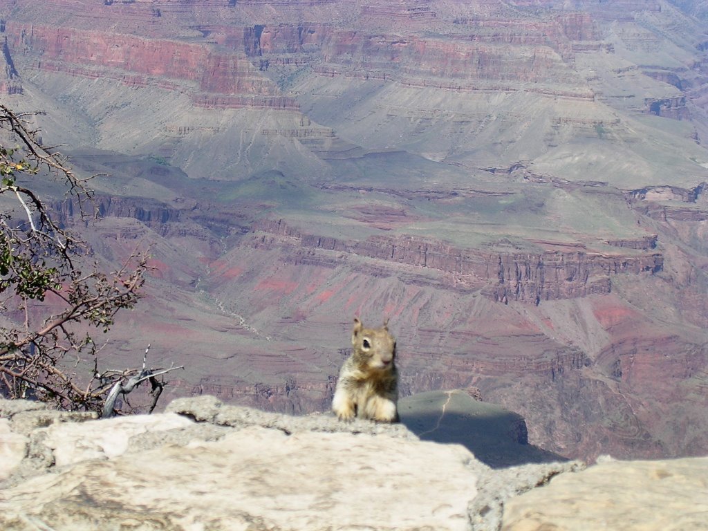
True to Ranger Amy’s prediction, squirrels at the rim were cozying up to hikers who obliged them with a sweet bit. I remembered the sticker I had won and fished it out for the benefit of a visitor who took its message to heart.
Still energized – or unconscious - we climbed aboard the red shuttle but exited at Pima Point to walk the final mile to Hermits Rest precariously close to the edge of the west rim. The driver was as talkative as on our first evening. As we trailed behind a bicyclist on the return journey, he stated he could not pass, as policy requires the bicyclist to come to a complete stop before the shuttle bus may pass. That the road is closed to traffic and therefore there would be no incoming cars, or that this rule is not stated anywhere does not alarm. This is, after all, like so many things in the U.S., for our safety.
We chose the historic El Tovar for lunch where a miniature United Nations attended to us. The host was French, the bus boy Ecuadorian, and our Russian waitress was not fazed at Eric’s dietary requests.
Time to leave approached and we visited, for the first time, the Canyon View Information Center. I had to ask rangers about earthquakes, but none felt anything. I also wondered about the legitimacy of calling the center Canyon View whereas there is no view of the canyon. The answer is too bureaucratic to relay, but it adopts the logic of the Mango Chicken Salad mind set.
A voice called me out before we could drive off. It was a fellow Phantom Rancher whose party had just arrived and whom we had passed at dawn. We congratulated each other. I hesitated to tell him how much time the climb took us because it was 2:30 p.m. and they had been at it for nine hours. But he asked, so how could I turn him down.
“It took us 4 hours and 5 minutes,” I replied.
The road took us to Williams and we noted the great number of highway patrol cars that had pulled drivers over. This region is a market made in heaven since it is quite likely the offenders will be from out of town and will never come back to contest their citation. Money in the bank – for our safety, of course.
We paid a return visit to Sedona and crossed the Verde Valley to perch ourselves in Jerome and inspect the sunset over Sedona’s red rocks. Copper mining made Jerome in its heyday. Today, the steep slopes of Mingus Mountain attract a hodgepodge of refuseniks, giving the small community much more of a rebellious persona than its neighbor on the north side of the valley. A sign on the street-facing window of the chief of police’s office asks people not to knock as it makes the chief feels as if he is in a cage…

Storms broke when we made our way down to Phoenix and instantly the creosote filled my nostrils. We also barely missed being hit by some kind of metal that had come loose from a truck on the freeway!
For a last supper, I brought Eric to the very lively confines of downtown Tempe. Thanks again to the presence of a major school, Arizona State University, the scene hops to a dynamic beat. Unlike the rest of the metropolitan area, walking is preferable. Save for Old Town Scottsdale (Scotland, as Eric called it), two million people rely on cars for work and play. Most commercial streets are six lanes wide and not designed with pedestrians in mind.
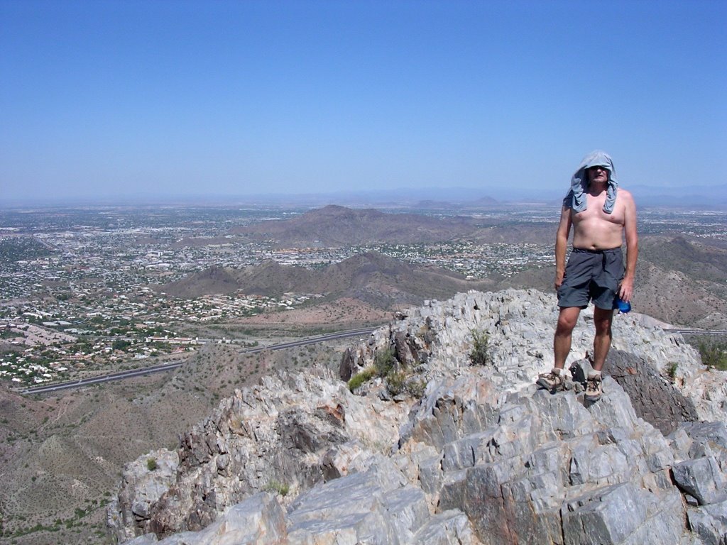
Because one can never have too much of a good thing, and because I have a tradition to uphold, we finished our week in Arizona’s wild lands with one last urban hike. I always hike either Camelback or Squaw Peak when I come to Phoenix and we picked the latter. It has now been renamed Piestewa Peak, but still stands 1,200 feet/365 meters above the trailhead and 1.2 miles/1,9 km away. You do the math!
It was 98°F/37°C when we reached the summit of this great urban park at 11 a.m. Exhilarated by all that had come before, we ran some of the way down. Another hiker followed our lead and thanked us for the momentum to run behind us.
All in all, we managed 48 miles/77 km and almost 11,000 feet/3.350 meters (eleven times the height of the Eiffel Tower) n one awesome week. I have never spent an entire week with another person, quite literally sharing each step of the way.
Eric hails from the north of France, more reserved and introverted than I, born and raised in Paris, but who could be from the tempestuous south, or even the other side of the border, the even more passionate Italian side.
We share a set of commonalities, more often than not with the rest of the continent, a series of acquis communs that act to formulate a social foundation and that are not subjected to modern-day reexaminations. At a time when the discourse in my adopted country seeks to enshrine discrimination in the constitution, when we argue that unfairness and inequality are good and necessary, when we debate the merits of torture with nary a sigh from the collectivity, I find comfort in a framework where the dialogue will not be hijacked by these profound aberrations.
Wanna go ski, Eric?
I landed in Burbank after a bumpy flight through the clouds that would drench the desert that evening.
The San Fernando Valley heat pleased me; I found the slight humidity comforting after the dryness.
I climbed over the Hollywood Hills to the Tower Record in West Hollywood. The notes of Elton John’s “Goodbye Yellow Brick Road” had resonated in my ears when the Phantom Ranch folks played it, and immediately evoked nostalgia. I learned English listening to this album (and others by the Rolling Stones, Pink Floyd, the Beatles, Genesis) back in the 1970s. I thought of another time.
“Tune me into the wild side of life.
I’m an innocent young child, sharp as a knife,
Take me to the garrets where the artists have died,
Show me the courtrooms where the judges have lied.”
The sun plunged into the Pacific, an inevitable freefall to rise over Eastern lands in another world. The multitude of puffy clouds reflected margins of fiery reds and exploded yellows. The brilliant light squeezed the remnants of the day, weighing down on the freeway, blinding me as I drove into it.
Suspended in my turbulent life, for an instant, I lost control, and felt free. In truth, I have seldom been in control.
“So keep your audition for somebody
Who hasn’t got so much to lose.
‘Cause you can tell by the lines I’m reciting,
That I’ve seen that movie too.”
No comments:
Post a Comment