The advent of fall does not usher a dazzling foliage riot in Southern California. If anything, temperatures spike. Free from the persistent blanket of the summer marine fog, coastal areas warm up nicely. Absent one of the ingredients necessary to halt photosynthesis, chlorophyll remains in the leaves: The red, orange and yellow pigments of New England and eastern Canada cannot surface.
Autumn announces the possibility of snow-free hiking in the high country damn nears its annual demise. This can only mean one thing: It affords another excuse to put on hiking boots and go play way up high, before I put on ski boots and go play way up high.
Ok, I’m high!
My friend Patricia attends a bi-annual journalism conference as a Santa Barbara City College professor and advisor. This latest Journalism Association of Community Colleges symposium took place on the campus of California State University in Fullerton. The event proposes several short classes, and writing and photography competitions. It gives students an opportunity to mingle and to test their talents in real-life scenarios. As her former student, I once attended those meetings and picked up several awards for editorial and critical review writing.
In all the university classes I have taken in the U.S., I have often enjoyed a dynamic relationship with my professors. Not so with Patricia. Academically, I received good grades, but we did not click on a personal level. Our rapport changed one night during the drive back from a conference in Los Angeles. With the protection of nighttime anonymity, she revealed personal details as the car swallowed mile after mile of roadway. Out of this conversation grew an intimacy that makes us good friends.
And hiking partners.
We planned to get together early on Sunday after the conference had ended. Fullerton is part of the greater Los Angeles, a metropolitan area that stretches north, east and south but mercifully not west, thanks to the Pacific Ocean. It sits at the top of Orange County, but it could be anywhere else and it would make little difference. This amalgam of hundreds of bland cities also lacks a traditional center. An agitated citizenry rushes around perpetually. Spiked blood courses through an astonishing network of arterial freeways, which connects the lackluster lot to itself, and permits epic commutes.
Public transit is another matter.
I woke up early to catch the first of five daily trains that link Santa Barbara, Los Angeles and San Diego, with intermediary stops. The ride to Fullerton, 120 miles/193 km distant, traces the coast then turns inland through coastal plains and valleys. Passengers have ample time to admire the more scenic portions during the 3hr27mn it took the beleaguered train to deliver me to my destination. To say that a 35 miles/56 kilometers per hour average dissuades patronage understates the obvious. Critics of government funding of public transit point to this self-fulfilling proposition as evidence people do not wish to abandon their cars. Yet, because it serves a region with upwards of 20 million residents, and because it skirts the pitfalls of driving a private automobile through congested cities, this route is popular, although infinitely less so than such statistics would warrant.
Several ingredients contribute to the failure of our rail network.
Amtrak, our national train company, does not own the rails. Several for-profit and competing companies privilege freight on their rail network. Such trains have priority over passenger trains. They make up the bulk of rail traffic. In many corridors, there is only one track, requiring judicious timing so that trains do not collide. They often sit a side spur while another train moves in the opposite direction.
The lines go through the middle of communities, but seldom on dedicated viaducts. Speed is reduced to minimize accidents and train engineers constantly blast their horn to warn inattentive drivers.
Other than in selected markets, trains are not electrified. Aging locomotives run on diesel. The tracks themselves need urgent upgrading.
Essentially, we have not moved much beyond the age of the iron horse. In the last quarter of a century, I have heard countless tales about the imminent arrival of the high-speed train. Before we engage that pipe dream, I would be happy to have regular trains moving at a normal speed, say 80 to 100 miles/130 to 160 kilometer per hour. I could get to Fullerton in an hour and a half, and find more value in the USD 23 Amtrak charges to get me there.
(Like so many policies that benefit society, support rests primarily in fringe groups, a constituency often neglected between election cycles. The favored solution to chronic congestion on the US 101 freeway between Santa Barbara and Ventura is to widen it so that more private cars may be accommodated. Existing rail tracks and right-of-way run by its side, but improving service stands little chance. We will never touch the underlying issue why the road is so busy. That would require looking into our sacrosanct real estate speculation archetype. Not a chance.)
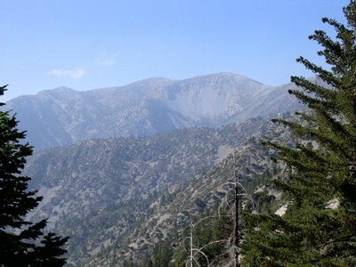
Our goal was to ascend Mount Baldy, the highest peak in the San Gabriel range. A bit of an anomaly, these mountains lie on an east-west axis. California’s coast ranges, the Sierra Nevada, Cascade, Great Basin ranges, Rocky Mountains, all trend north-south. It joins the contrarian club with the neighboring San Bernardino, Little San Bernardino, Santa Monica, Santa Ynez and Colorado’s rebellious San Juan mountains.
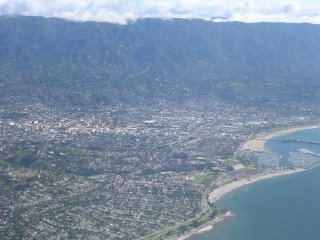
This traverse range separates the sprawling eastern suburbs of Los Angeles from the high desert Antelope Valley. Not much of a rampart. While urbanization cannot drape over this steep obstacle, it has oozed around it. Don’t look for antelopes in the Antelope Valley. It is a perpetually windswept hell of look-alikes, ugly subdivisions interspersed with ramshackle, forsaken hamlets.
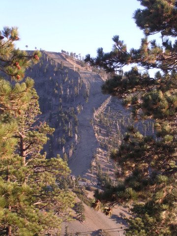
The sheer San Gabriel Mountains do provide a physical barrier for the smog that chokes all inland valleys. The range contributes to its formation by channeling it into the lowlands and blocking its egress. Boxed in by a hurdle that rises to 10,000 feet/3.000 meters, the smog bumps on the south-facing slopes and engulfs all. At low elevations, vegetation exhibits damage from exposure to noxious air.
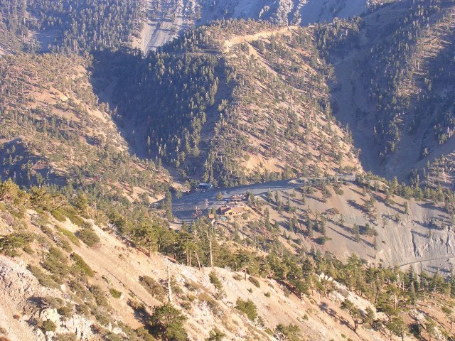
But we were headed far above these injured slopes. The road enters the mountain in narrow San Antonio Canyon and quickly ditches the dreadful Inland Empire. If only because we face away from it, the presence of this ill-named region (empire, my ass!) fades from our consciousness.
Barely 10 miles/16 kilometers from a major freeway, we have escaped to a world of pine trees and wooden cottages in the small settlement of Mount Baldy. Often under siege from lowland pressures, here the San Gabriel Mountains isolate and inspire us. A few more minutes and we pull into the parking lot of the
Mt. Baldy ski resort.
And herein lies the beauty of living in Los Angeles.
As numerous tourist brochures point out, a winter day can start at the beach and end on the slopes. The shortest distance between sand and snow is no more than an hour’s drive. From downtown LA – not that it is a residential center although 10,000 to 12,000 homeless people live on the streets there – it is a matter of minutes west to the beach or to a mountain wilderness, and a couple of hours to (yeah) Santa Barbara, San Diego and the Mexican border, Palm Springs and desert resorts.
Who could say no to those advantages? The tide of interested parties has multiplied over the years. At any given time, the roads to these delightful spots strain to shuttle all who share similar desires. Resistance is futile.
With Elisabeth, her mom Marie-Christine and sister Laurence, I once decided to probe the marketing claims. The day after Christmas, we visited Santa Monica beach, and headed to the
Mountain High ski area after lunch. Driving through endless suburbs was a journey of faith. Until a favorable bend in the road moments before we reached our destination near Wrightwood, it did not feel as if we were out on a ski trip. The resort touts the lack of mountain driving – ain’t no lie!
Mt. Baldy promotes “real skiing, real close.” I will concede the second claim. But for vast and varied terrain, it cannot compete with ski industry marquee names. Southern California winters pale when contrasted with more continental climates. Snow depths vary greatly from year to year, and resorts rely on snowmaking for coverage more and more. Mt. Baldy also lacks a basic base lodge. The doublewide trailer that watches over the dirt parking lots does not a resort make. But hey, you came here to ski, not to sip hot cocoa, did ya?
We paid $15 to ride the chairlift to Baldy Notch to save ourselves the 1,300-foot/400-meter from the base area. (Refer to another blog entry, “
Above the 49th,” for a cost comparison on summer chairlifts in Canada.) It got a bit windy as we ascended on the rickety two-person chair. Life echoes more vividly, even on an antiquated lift. Patricia asked me not to rock the chair.

We set out on an abrupt gravel service road. At nearly 8,000 feet/2.440 meters, Patricia soon struggled to catch her breath. As one climbs higher, the concentration of oxygen remains constant but the barometric pressure drops markedly. At 12,000 feet/3.650 meters, it is 40 percent less than at sea level. Each breath draws fewer oxygen molecules and breathing accelerates to make up the shortfall. This is not high altitude mountain sickness. Everyone experiences benign hyperventilation and shortness of breath to some degree.
Physicians recommend several days of acclimatization before engaging in strenuous activity above 8,000 feet. This proposition is not practical for weekend warriors. A rapid ascent (by car or plane or gondola) will exacerbate the effects of elevation.
Acute Mountain Sickness (AMS) kicks in over 10,000 feet or 3.000 meters and is considered to be a neurological problem caused by changes in the central nervous system. Symptoms include headache, dizziness, fatigue, shortness of breath, loss of appetite, nausea, disturbed sleep, and a general feeling of malaise. These symptoms conform to a pretty generic diagnosis and will respond to pain medication and descent.
Nausea, vomiting, increased weakness and fatigue, and decreased coordination require immediate descent or specialized medication. Once acclimatized to a lower elevation, ascent can resume. Further stages include depleted oxygen in the bloodstream and fluid buildup in the lungs or brain, leading to life threatening conditions of High Altitude Pulmonary or Cerebral Edema (HAPE and HACE). Evacuation is mandatory to elevations below 4,000 feet/1.220 meters for medical attention.
These symptoms develop after several days, not upon arrival. Patricia needed to take it easy, and at a constant pace, to attune her body to the environment. It is smarter to assume a steady, possibly slow rhythm with occasional rest, than to go all out, tire and rest frequently.
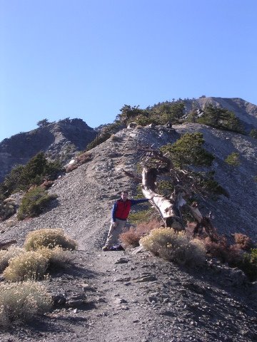
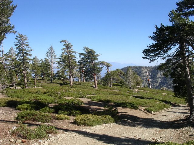
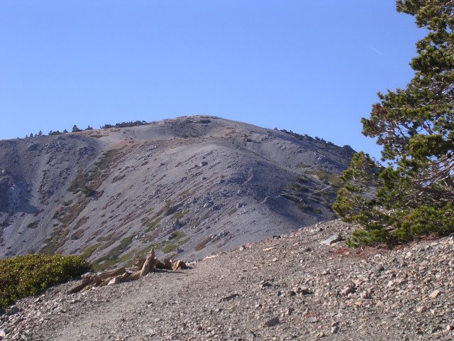
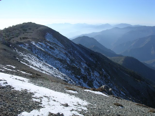
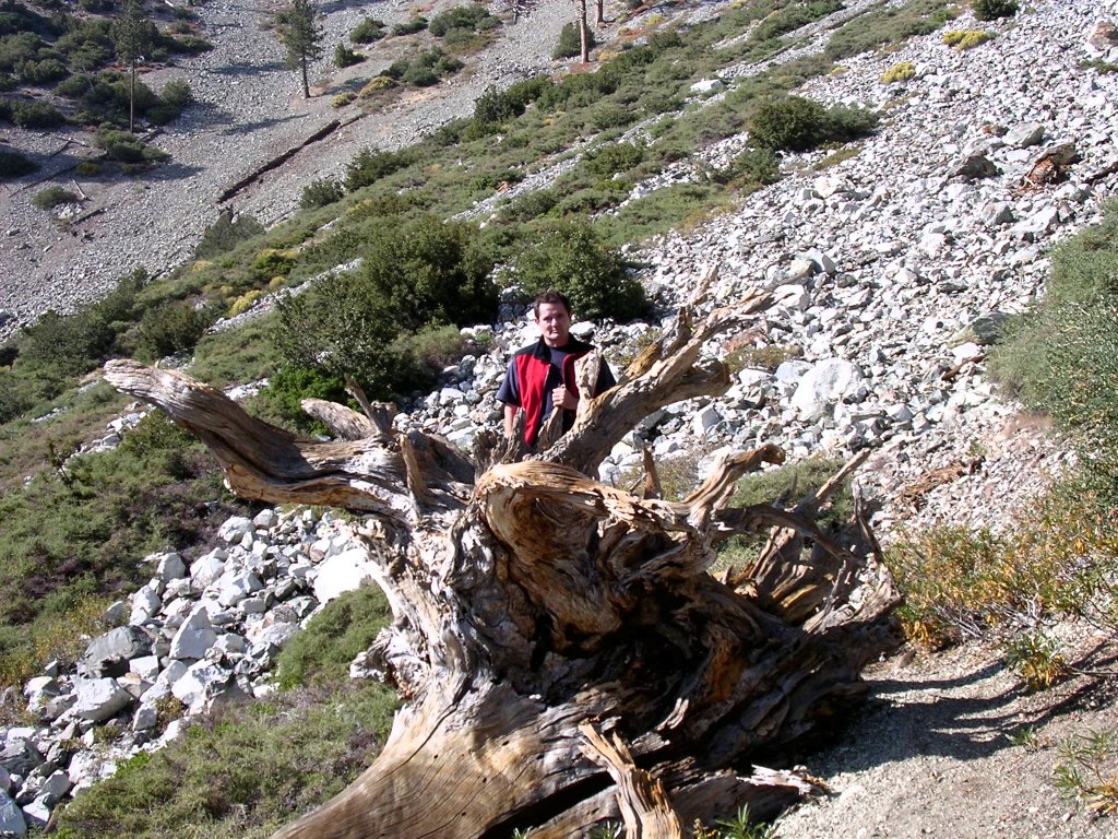
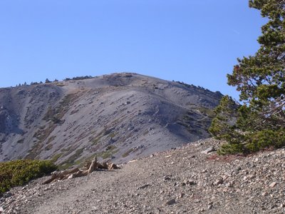
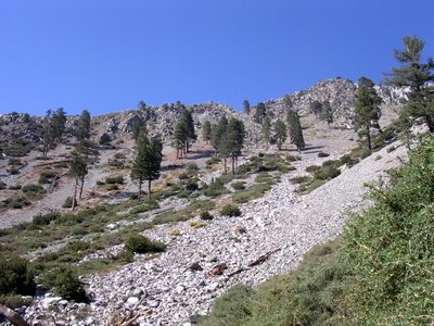
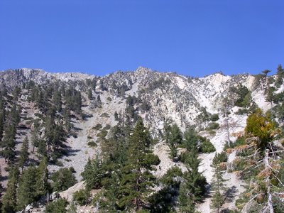
She was not necessarily convinced and the 2,200-foot/670-meter climb ahead did not restore her confidence, but she pressed on. Pines and incense cedars outline views into the Cucamonga and Sheep Mountain wilderness areas. Awed by the alpine scenery, we reminded ourselves periodically that we were less than 20 minutes from the second largest metropolitan area in the country. Squint, and snowy San Gorgonio peaks out at 11,499 feet/3.505 meters in the next range. Chinquapin hugs the ground and it’s easy to imagine being in the Sierra Nevada. On clear days, the southern part of the range is visible, as is Santa Catalina Island. The trick rests in figuring out when those clear days hit!


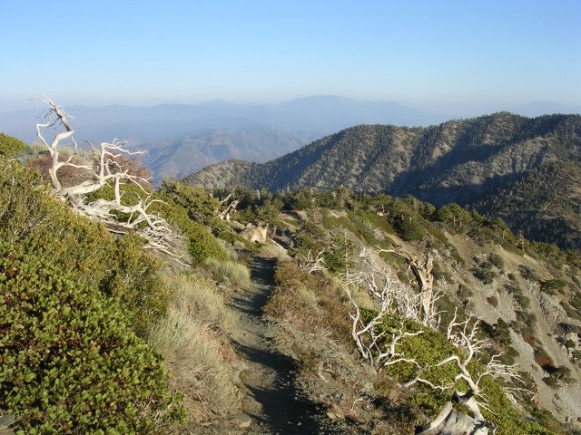
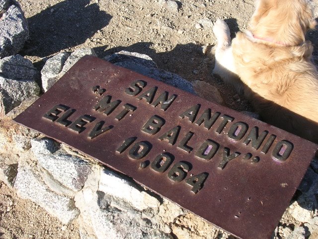
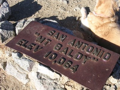
Today, the typical haze restricts the views to the Mojave Desert and the Los Angeles basin. We leave timberline behind and escalate a false peak before re-energizing for our final approach. The official name is San Antonio, but its most obvious physical attribute has given rise to the nickname.
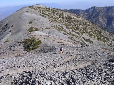
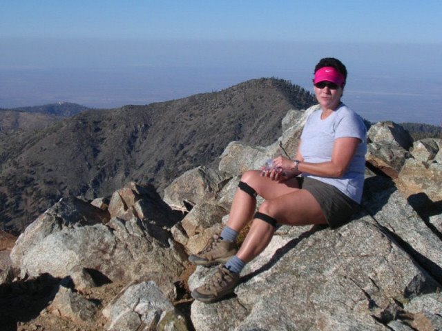
At 10,064 feet/3.068 meters, Patricia squeezes her first climb over 10,000 feet. It’s So Cal’s third tallest mountain, behind San Gorgonio and San Jacinto (10,804 feet/3.293 meters).
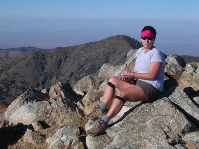
She has also conquered half of our 7-mi/11¼-km journey.
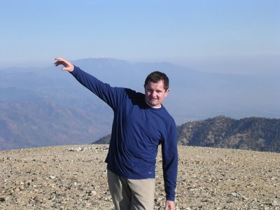
The crisp air intoxicates me, as usual. I am stoked at the sight of winter’s first snowfall still lingering on Baldy’s north side. Patricia shares my exhilaration with a grin.

A small group and a dog prepare to descend. A man suggested we tag along and rejoin the base area by way of San Antonio Falls. I lack familiarity with the trails of the
Angeles National Forest and we declined. He acted a bit miffed, somehow. Privately, I was also looking forward to a ride down the chairlift.
The sun’s last rays bathe the upper reaches of the chair and the saddle in a glorious glow. As we drop back down toward the parking area, it gets colder and colder in the shade of the precipitous mountains. On this first day back on standard time, darkness arrives early in the canyon.


Reluctantly, we abandoned our mountain playground. I am very fond of hiking around 9,000-13,000 feet/2.750-4.000 meters and this little adventure brought me home.
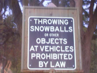
Our car was about to bring me to my other home when I caught a sign out of the corner of my eye.
I wish to express my deepest gratitude to whichever governmental agency acted upon this worrisome example of a society run amok. Before the wheel of regulation started rolling, I am thankful concerned citizens decided to stop ducking incoming projectiles.
We cannot live in fear.
Fiercely independent, we long for an existence uncontaminated by life. In this instance, the trauma to our fragile psyche and to our paint job is too great. Our family values had to organize to withstand this assault.
My vote goes for a mandatory requirement to wear latex gloves before participating – if one ever must pursue this folly – because I wish not to be on the receiving end of any of your germs, no thank you.
Protect us all, please.
Protect us from ourselves, especially.
Do it for our safety.
Reassure us that our pathetic mediocrity can see another day without running into a mirror.
Now that it has been elevated to the rank of a (surely deadly) weapon, I can only advise to refrigerate the ammunition.
Let’s stock up and fight!
UPDATE:
Almost a year later, Patricia and I revisited San Antonio canyon. We had planned to climb Mount Islip at the headwaters of the San Gabriel River. After a two-hour drive to the LA area in mid-September, we are greeted by signs indicating all campgrounds and trails upriver are closed. We learn that a winter storm triggered a slide and washed out the state highway.
Three years ago!
Not easily defeated by lax maintenance schedules, we set our sights on Santa Anita canyon. Twenty minutes later, we hit upon another road closure! (When I decided to drop by Canter’s that evening for poppy seed hamatashen – it was Rosh Hashana, after all – it, too, was closed…)

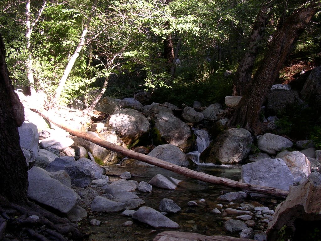
These two setbacks led us to consider the Mount Baldy area anew. This time, we traipsed over Icehouse Canyon to a saddle that leads to several peaks that dominate the Cucamonga Wilderness Area. A small collection of frequently dilapidated cottages lines the banks of a perennial creek. The trail soon left the shady confines and rose steadily past stately sugar pines and incense cedars. Expansive views of serrated ridgelines and jagged summits frame this little canyon and I became euphoric once more. Even though we hiked at relatively low elevations, topping at 7,600 feet/2.315 meters, the subalpine scenery recalled the paradisiacal high country, and only a slight haze over the high peaks betrayed our location.

I defy you to imagine 20 million folks amassed on the other side of these beautiful mountains.

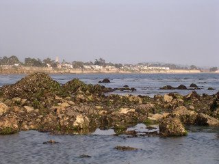
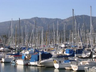 The harbor with the Santa Ynez mountains in the background.
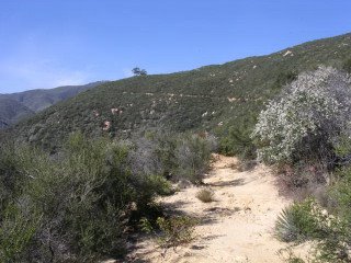 Approaching the eucalyptus trees landmark on the Cold Springs trail, halfway to Camino Cielo, the mountain's ridgetop.
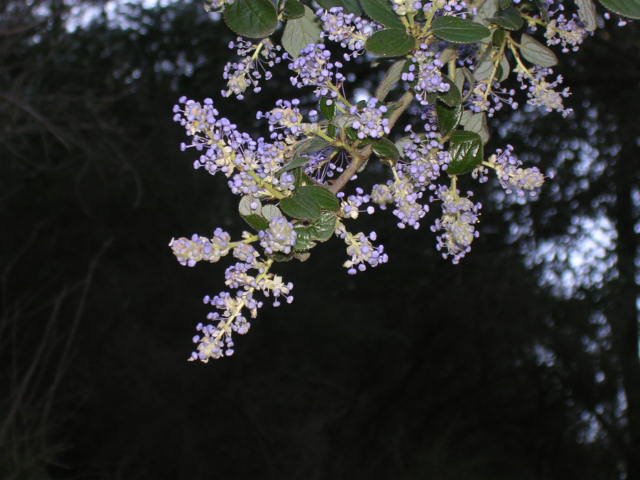
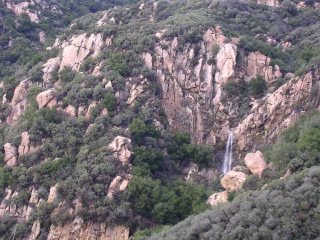 A seasonal and rare waterfall in a side canyon of the Rattlesnake drainage.
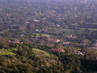 Montecito foothills.
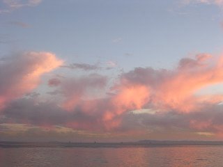
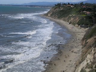 Henry's Beach, officially named Arroyo Burro, below the Wilcox Property.
 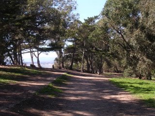 Bluff top trail on the Wilcox Property, one of four large oceanfront tract that has been saved from development. Since actors Kirk and Michael Douglas put some money toward its preservation, it now goes by the gentle name of Douglas Family Preserve.
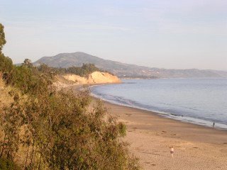
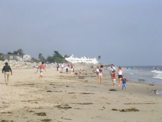 Santa Claus Beach, with Moorish-looking building in background.
 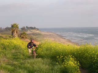 Biker amidst mustard plants at Ellwood, another of the preserved properties.
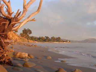
 Summerland Beach.
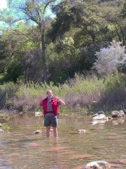
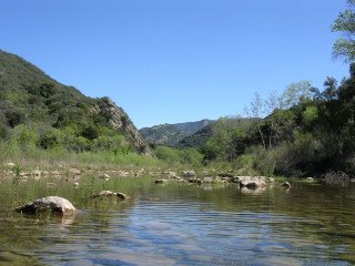 The Santa Ynez River, on the backside of the eponymous mountains.